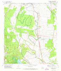
1972 Map of Woodworth East
USGS Topo · Published 1974About this map
Alexandria and its southern agricultural hinterland dominate this 1970s landscape, where the alluvial plains of Bayou Boeuf meet the managed timberlands of the Alexander State Forest. The map reveals a complex water management system, including the Diversion Channel and numerous sloughs like Harris Slough and Plantation Slough, reflecting the region's historic reliance on drainage for cultivation. A dense network of rail lines, including the Missouri Pacific and Texas and Pacific, highlights the area's role as a transportation hub for timber and agricultural products.
Find a feature on this map
56 named features on this map. Tap any name to fly to it.
Don’t see what you’re looking for? This feature index may not catch every label — zoom into the map to look around manually.
Map Details
Editions of this 1972 Woodworth East Map
3 editions found
Other maps of this area

1935 · Lecompte
USGS Topo · 1:62,500

1941 · Alexandria
USGS Topo · 1:62,500

1941 · Boyce
USGS Topo · 1:62,500

1945 · Boyce SE
USGS Topo · 1:31,680

1949 · Boyce SE
USGS Topo · 1:31,680

1953 · Alexandria
USGS Topo · 1:250,000

1955 · Alexandria
USGS Topo · 1:250,000

1956 · Forest Hill
USGS Topo · 1:62,500

1956 · Boyce
USGS Topo · 1:62,500

1957 · Alexandria
USGS Topo · 1:62,500