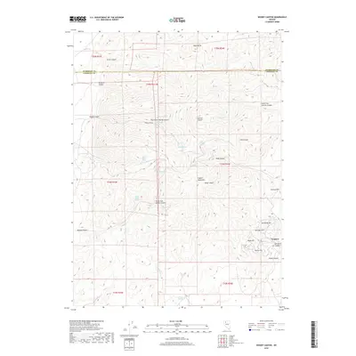
2018 Map of Woody Canyon
USGS Topo · Published 2018About this map
Eugene Mountains define the high-desert landscape of this corner of the Great Basin, where the boundary between Humboldt and Pershing counties cuts across the high peaks. The mining settlement of Tungsten sits in the southeast, positioned near the mineral-rich slopes of Humboldt Hill and Springer Hill. This area is characterized by a complex network of dry canyons and vital water sources, with names like Sage Chicken Spring, Three Forks Spring, and Millers Spring indicating the importance of reliable water in this arid environment. The map details the rugged drainage systems of Woody Canyon and Bonita Canyon, alongside the prominent heights of Alpha Butte and Sutton Hill. These features reveal a landscape shaped both by natural erosive forces and the industrial reach of mining operations focused on the local hillsides.
Find a feature on this map
43 named features on this map. Tap any name to fly to it.
Don’t see what you’re looking for? This feature index may not catch every label — zoom into the map to look around manually.
Map Details
Editions of this 2018 Woody Canyon Map
This is the sole edition of this map. No revisions or reprints were ever made.
Other maps of this area

1931 · Lovelock
USGS Topo · 1:250,000

1935 · Lovelock
USGS Topo · 1:250,000

1939 · Eugene Mountains Area
USGS Topo · 1:62,500

1942 · Eugene Mountains Area
USGS Topo · 1:62,500

1955 · Lovelock
USGS Topo · 1:250,000

1956 · Imlay
USGS Topo · 1:62,500

1959 · Lovelock
USGS Topo · 1:250,000

1971 · Rye Patch Reservoir North
USGS Topo · 1:24,000
1971 · Jungo NE
USGS Topo · 1:24,000
1971 · Alpha Mountain
USGS Topo · 1:24,000