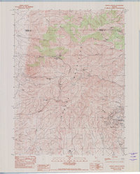
1982 Map of Woody Canyon
USGS Topo · Published 1982About this map
The Eugene Mountains dominate this high-desert landscape in the early 1980s, revealing a terrain defined by mining history and vital water sources. Mining activity is concentrated on the eastern slopes, centered around the Nevada Massachusetts Tungsten Mine and the settlement of Tungsten. These operations, along with the Blackbird Mine, Wheelbarrow Mine, and Republican Mine further north, underscore the industrial importance of this range within the Humboldt and Pershing County borderlands.
Find a feature on this map
35 named features on this map. Tap any name to fly to it.
Don’t see what you’re looking for? This feature index may not catch every label — zoom into the map to look around manually.
Map Details
Editions of this 1982 Woody Canyon Map
This is the sole edition of this map. No revisions or reprints were ever made.
Other maps of this area

1931 · Lovelock
USGS Topo · 1:250,000

1935 · Lovelock
USGS Topo · 1:250,000

1939 · Eugene Mountains Area
USGS Topo · 1:62,500

1942 · Eugene Mountains Area
USGS Topo · 1:62,500

1955 · Lovelock
USGS Topo · 1:250,000

1956 · Imlay
USGS Topo · 1:62,500

1959 · Lovelock
USGS Topo · 1:250,000

1971 · Rye Patch Reservoir North
USGS Topo · 1:24,000
1971 · Jungo NE
USGS Topo · 1:24,000
1971 · Alpha Mountain
USGS Topo · 1:24,000