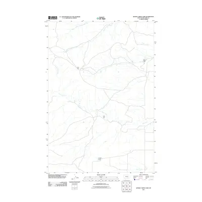
2011 Map of Woody Creek Camp
USGS Topo · Published 2011About this map
Woody Creek Camp and Crows Nest Camp anchor this 2011 topographical view of Big Horn County, Montana. The landscape is defined by the branching tributaries of Woody Creek and the forks of Two Leggins Creek, including Middle Fork Two Leggins Creek and South Fork Two Leggins Creek. This area of the Crow Indian Reservation reflects a rural ranching or resource management character, underscored by the presence of water control structures like Eagle Land Number 1 Dam and Campbell Number 1 Dam. The map's sparse settlement pattern and network of local roads illustrate the vast, open spaces of southern Montana, where life and activity are centered around seasonal water sources like Spring Creek.
Find a feature on this map
8 named features on this map. Tap any name to fly to it.
Don’t see what you’re looking for? This feature index may not catch every label — zoom into the map to look around manually.
Map Details
Editions of this 2011 Woody Creek Camp Map
This is the sole edition of this map. No revisions or reprints were ever made.
Other maps of this area

1894 · St. Xavier
USGS Topo · 1:125,000

1894 · Fort Custer
USGS Topo · 1:125,000

1901 · St. Xavier
USGS Topo · 1:125,000

1915 · Spenceville
USGS Topo · 1:31,680

1954 · Hardin
USGS Topo · 1:250,000

1957 · Hardin
USGS Topo · 1:250,000

1958 · Hardin
USGS Topo · 1:250,000

1960 · St Xavier
USGS Topo · 1:24,000

1960 · Walker Hill
USGS Topo · 1:24,000

1960 · Hardin SW
USGS Topo · 1:24,000