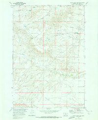
1969 Map of Woody Creek Camp
USGS Topo · Published 1973About this map
The Crow Indian Reservation provides the geographical setting for this late 1960s study of the Big Horn Basin. The landscape is defined by the complex drainage systems of Middle Fork Two Leggins Creek and South Fork Two Leggins Creek, which carve through the high terrain in the northern sections. Central to the map are the isolated outposts of Crows Nest Camp and Woody Creek Camp, reflecting the localized settlement patterns within the reservation. The presence of Whiskey Coulee and Wild Horse Coulee suggests a history tied to seasonal water flow and livestock movement. To the south, the terrain levels slightly near the small locality of Beau and along Spring Creek, where a Gravel Pit indicates small-scale resource extraction. This survey was conducted as part of a Department of the Interior program focused on the development of the Missouri River Basin.
Find a feature on this map
13 named features on this map. Tap any name to fly to it.
Don’t see what you’re looking for? This feature index may not catch every label — zoom into the map to look around manually.
Map Details
Editions of this 1969 Woody Creek Camp Map
This is the sole edition of this map. No revisions or reprints were ever made.
Other maps of this area

1894 · St. Xavier
USGS Topo · 1:125,000

1894 · Fort Custer
USGS Topo · 1:125,000

1901 · St. Xavier
USGS Topo · 1:125,000

1915 · Spenceville
USGS Topo · 1:31,680

1954 · Hardin
USGS Topo · 1:250,000

1957 · Hardin
USGS Topo · 1:250,000

1958 · Hardin
USGS Topo · 1:250,000

1960 · St Xavier
USGS Topo · 1:24,000

1960 · Walker Hill
USGS Topo · 1:24,000

1960 · Hardin SW
USGS Topo · 1:24,000