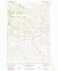
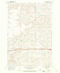
1969 Map of Woody Mountain NW
USGS Topo · Published 1980About this map
Crow Indian Reservation Boundary lines define the southwestern landscape of this Yellowstone County quadrangle, where the upland terrain gives way to a complex drainage network. The Crow Indian Reservation occupies much of the western portion of the sheet, characterized by the prominent elevation of Woody Mountain. This 1969 survey, photorevised in 1980, details the seasonal and perennial waterways that carved this high-plains environment.
Find a feature on this map
11 named features on this map. Tap any name to fly to it.
Don’t see what you’re looking for? This feature index may not catch every label — zoom into the map to look around manually.
Map Details
Editions of this 1969 Woody Mountain NW Map
2 editions found
Other maps of this area

1893 · Huntley
USGS Topo · 1:125,000

1954 · Billings
USGS Topo · 1:250,000

1957 · Billings
USGS Topo · 1:250,000

1958 · Billings
USGS Topo · 1:250,000

1967 · Soda Springs
USGS Topo · 1:24,000

1967 · Cottonwood Creek
USGS Topo · 1:24,000
1967 · Badbaby Coulee
USGS Topo · 1:24,000
1969 · Woody Mountain NW
USGS Topo · 1:24,000
1969 · Indian Arrow
USGS Topo · 1:24,000
1969 · Gails Coulee
USGS Topo · 1:24,000