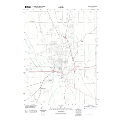
2010 Map of Wooster
USGS Topo · Published 2010About this map
Wooster serves as the central hub for this Wayne County survey, showing a landscape defined by its intersection of historical agriculture and modern infrastructure. The city center is surrounded by specialized institutions and family-named landmarks, including the Wayne County Fairgrounds and the Wayne County Infirmary. Significant water features like Killbuck Creek and Apple Creek wind through the region, while the periphery is dotted with small outlying settlements such as Mechanicsburg, Devil Town, and Honeytown. Genealogists will find a wealth of data across numerous burial grounds, from the large Wooster Cemetery and Saint Marys Cemetery near the city, to more remote locations like Branch Cemetery and Pioneer Cemetery. The northern reaches are characterized by the Wayne County Airport and the community of Madisonburg, reflecting a well-established network of transport and small-town settlement patterns that have shaped this part of Ohio.
Find a feature on this map
85 named features on this map. Tap any name to fly to it.
Don’t see what you’re looking for? This feature index may not catch every label — zoom into the map to look around manually.
Map Details
Editions of this 2010 Wooster Map
This is the sole edition of this map. No revisions or reprints were ever made.
Other maps of this area

1901 · Wooster
USGS Topo · 1:62,500

1903 · Wooster
USGS Topo · 1:62,500

1906 · West Salem
USGS Topo · 1:62,500

1908 · West Salem
USGS Topo · 1:62,500

1912 · Loudonville
USGS Topo · 1:62,500

1914 · Loudonville
USGS Topo · 1:62,500

1915 · Millersburg
USGS Topo · 1:62,500

1943 · Millersburg
USGS Topo · 1:62,500

1943 · Loudonville
USGS Topo · 1:62,500

1950 · Marion
USGS Topo · 1:250,000