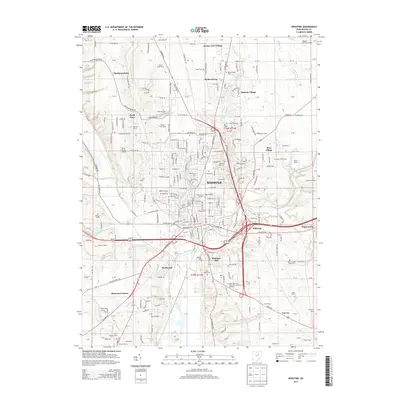
2013 Map of Wooster
USGS Topo · Published 2013About this map
Wooster and its surrounding Wayne County landscape are centered on the valley where Apple Creek meets Killbuck Creek. In the early 21st century, the area reflects a deeply rooted educational and agricultural heritage, anchored by the campus of The Coll of Wooster and its Papp Stadium, alongside the Ohio State Univ Agricultural Technical Institute. The map captures numerous family-named agricultural holdings such as Maple Lane Farm, Cebul Farm, and Kuhtes Fruit Farm, demonstrating the persistent rural character surrounding the city center.
Find a feature on this map
104 named features on this map. Tap any name to fly to it.
Don’t see what you’re looking for? This feature index may not catch every label — zoom into the map to look around manually.
Map Details
Editions of this 2013 Wooster Map
This is the sole edition of this map. No revisions or reprints were ever made.
Other maps of this area

1901 · Wooster
USGS Topo · 1:62,500

1903 · Wooster
USGS Topo · 1:62,500

1906 · West Salem
USGS Topo · 1:62,500

1908 · West Salem
USGS Topo · 1:62,500

1912 · Loudonville
USGS Topo · 1:62,500

1914 · Loudonville
USGS Topo · 1:62,500

1915 · Millersburg
USGS Topo · 1:62,500

1943 · Millersburg
USGS Topo · 1:62,500

1943 · Loudonville
USGS Topo · 1:62,500

1950 · Marion
USGS Topo · 1:250,000