
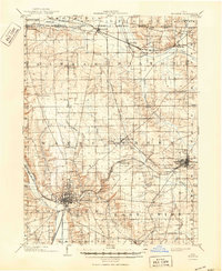
1903 Map of Wooster
USGS Topo · Published 1938About this map
Wooster University stands as a prominent academic landmark overlooking the county seat in this detailed survey of Wayne County, Ohio. The landscape is defined by its industrial and agricultural vitality, anchored by the State Experiment Station and the Childrens Home. Transport networks of the early twentieth century are intricately documented, showing the convergence of the Pennsylvania System and the Fort Wayne and Chicago R R at hubs like Orrville.
Find a feature on this map
49 named features on this map. Tap any name to fly to it.
Don’t see what you’re looking for? This feature index may not catch every label — zoom into the map to look around manually.
Map Details
Editions of this 1903 Wooster Map
2 editions found
Other maps of this area

1901 · Massillon
USGS Topo · 1:62,500

1901 · Wooster
USGS Topo · 1:62,500

1903 · Massillon
USGS Topo · 1:62,500

1903 · Akron
USGS Topo · 1:62,500

1904 · Medina
USGS Topo · 1:62,500

1904 · Wellington
USGS Topo · 1:62,500

1905 · Akron
USGS Topo · 1:62,500

1906 · Medina
USGS Topo · 1:62,500

1906 · Wellington
USGS Topo · 1:62,500

1906 · West Salem
USGS Topo · 1:62,500