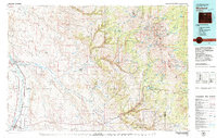
1979 Map of Worland
USGS Topo · Published 1979About this map
Worland serves as the focal point for this 1979 survey of north-central Wyoming, where the Burlington Northern railroad follows the course of the Bighorn River northward through Eccles and Manderson. The map reveals a landscape defined by the transition from irrigated river valleys to the arid Basin Flats and the elevated reaches of the Bighorn Mountains. Industrial activity is centered on energy extraction, specifically the Cottonwood Creek Oil and Gas Field and the Hidden Dome Oil and Gas Field, which dot the landscape with numerous wells and access roads.
Find a feature on this map
49 named features on this map. Tap any name to fly to it.
Don’t see what you’re looking for? This feature index may not catch every label — zoom into the map to look around manually.
Map Details
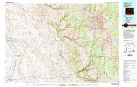
Editions of this 1979 Worland Map
2 editions found
Other maps of this area

1895 · Dayton
USGS Topo · 1:125,000

1898 · Bald Mountain
USGS Topo · 1:125,000

1899 · Cloud peak
USGS Topo · 1:125,000

1900 · Fort McKinney
USGS Topo · 1:125,000

1901 · Cloud Peak
USGS Topo · 1:125,000

1901 · Dayton
USGS Topo · 1:125,000

1901 · Bald Mountain
USGS Topo · 1:125,000

1903 · Fort McKinney
USGS Topo · 1:125,000

1909 · Sheridan
USGS Topo · 1:125,000

1911 · Sheridan
USGS Topo · 1:125,000