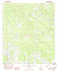
1983 Map of Wortham
USGS Topo · Published 1983About this map
Little Biloxi River winds through the heart of this Harrison County landscape, defining the rural character of southeastern Mississippi in the early 1980s. The settlement pattern is anchored by small communities like Lizana, Hunter, and Wortham, with numerous family-named cemeteries such as Wedgeworth Cem and Lizard Cem providing essential clues for genealogical research. The eastern edge of the map is dominated by the Desoto National Forest and the Illinois Central Gulf railroad, which historically shaped the timber and transport economy of the region.
Find a feature on this map
103 named features on this map. Tap any name to fly to it.
Don’t see what you’re looking for? This feature index may not catch every label — zoom into the map to look around manually.
Map Details
Editions of this 1983 Wortham Map
This is the sole edition of this map. No revisions or reprints were ever made.
Other maps of this area

1953 · Mobile
USGS Topo · 1:250,000

1954 · McHenry
USGS Topo · 1:62,500

1954 · Gulfport North
USGS Topo · 1:24,000

1955 · Savannah
USGS Topo · 1:62,500

1956 · Vidalia
USGS Topo · 1:24,000

1956 · Gulfport NW
USGS Topo · 1:24,000

1957 · Mobile
USGS Topo · 1:250,000

1960 · Mobile
USGS Topo · 1:250,000

1963 · Mobile
USGS Topo · 1:250,000

1965 · Mobile
USGS Topo · 1:250,000