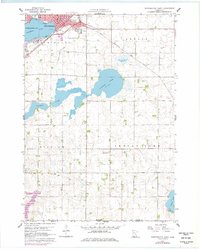
1960 Map of Worthington South
USGS Topo · Published 1977About this map
The prairie landscape of southern Nobles County is defined by its glacial lakes and the rising regional hub of Worthington. Situated along the northern edge of the map, the town's expansion is visible through 1970s revisions, including the presence of a Drive-in Theater and parks like Centennial Park and Chatauqua Park bordering Okabena Lake. The map illustrates a critical railroad junction where the Chicago and North Western meets the Chicago Rock Island and Pacific, a network that facilitated the agricultural growth of townships like Lorain and Bigelow.
Find a feature on this map
23 named features on this map. Tap any name to fly to it.
Don’t see what you’re looking for? This feature index may not catch every label — zoom into the map to look around manually.
Map Details
Editions of this 1960 Worthington South Map
2 editions found
Other maps of this area

1954 · Fairmont
USGS Topo · 1:250,000

1958 · Fairmont
USGS Topo · 1:250,000

1960 · Brewster
USGS Topo · 1:24,000

1960 · Reading
USGS Topo · 1:24,000

1960 · Bigelow
USGS Topo · 1:24,000

1960 · Worthington North
USGS Topo · 1:24,000

1960 · Worthington South
USGS Topo · 1:24,000

1960 · Round Lake
USGS Topo · 1:24,000

1970 · Harris
USGS Topo · 1:24,000

1972 · Ocheyedan
USGS Topo · 1:24,000