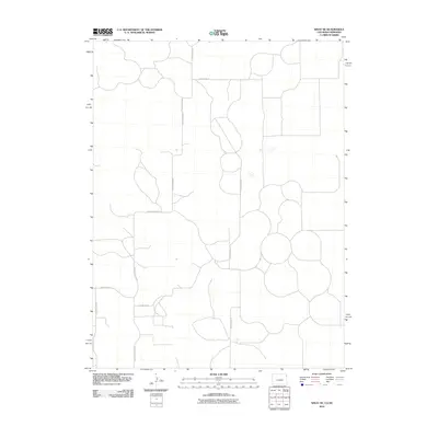
2010 Map of Wray NE
USGS Topo · Published 2010About this map
Yuma County, Colorado, and portions of Nebraska meet in this high plains landscape defined by its rigorous sectional grid and circular field patterns. The 2010 survey highlights a sparse rural infrastructure where transit is governed by an exacting network of gravel and local routes such as County Road RR and County Road SS. These roads delineate the vast agricultural holdings that characterize the region, showing the evolution of land use in the early twenty-first century. For researchers and local historians, the map's value lies in its precise layout of property boundaries and the specific naming of secondary arteries like County Road PP 5/10 and County Road 40.5, which provide the structural framework for this remote corner of the tri-state area.
Find a feature on this map
7 named features on this map. Tap any name to fly to it.
Don’t see what you’re looking for? This feature index may not catch every label — zoom into the map to look around manually.
Map Details
Editions of this 2010 Wray NE Map
This is the sole edition of this map. No revisions or reprints were ever made.
Other maps of this area

1954 · Sterling
USGS Topo · 1:250,000

1954 · McCook
USGS Topo · 1:250,000

1957 · McCook
USGS Topo · 1:250,000

1958 · McCook
USGS Topo · 1:250,000

1958 · Sterling
USGS Topo · 1:250,000
1961 · Haigler
USGS Topo · 1:24,000

1961 · Laird
USGS Topo · 1:24,000

1961 · Wray
USGS Topo · 1:24,000

1971 · Alvin SW
USGS Topo · 1:24,000

1971 · Alvin
USGS Topo · 1:24,000