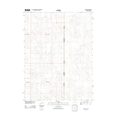
2013 Map of Wray NE
USGS Topo · Published 2013About this map
The Colorado Nebraska state line bisects this high-plains landscape, where the geometry of the Public Land Survey System dictates the modern infrastructure. This 2013 survey records a sparse network of county roads following section lines across the undulating terrain of Yuma County and Dundy County. The rural transit network is defined by routes such as Co Road RR, Co Road 46, and Co Road PP, which serve as the primary lifelines for the agricultural parcels in this border region. The boundary between Yuma Co Dundy Co intersects the state line, marking a point where administrative and geographic limits meet. The landscape is characterized by its isolation and the systematic division of land into townships like t003n r042w, illustrating the enduring influence of early 20th-century land management on the modern American West.
Find a feature on this map
12 named features on this map. Tap any name to fly to it.
Don’t see what you’re looking for? This feature index may not catch every label — zoom into the map to look around manually.
Map Details
Editions of this 2013 Wray NE Map
This is the sole edition of this map. No revisions or reprints were ever made.
Other maps of this area

1954 · Sterling
USGS Topo · 1:250,000

1954 · McCook
USGS Topo · 1:250,000

1957 · McCook
USGS Topo · 1:250,000

1958 · McCook
USGS Topo · 1:250,000

1958 · Sterling
USGS Topo · 1:250,000
1961 · Haigler
USGS Topo · 1:24,000

1961 · Laird
USGS Topo · 1:24,000

1961 · Wray
USGS Topo · 1:24,000

1971 · Alvin SW
USGS Topo · 1:24,000

1971 · Alvin
USGS Topo · 1:24,000