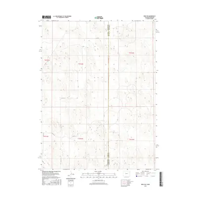
2016 Map of Wray NE
USGS Topo · Published 2016About this map
The Colorado Yuma Co Nebraska Dundy Co state line defines the eastern edge of this agricultural survey, marking the transition between the High Plains of Colorado and Nebraska. This 2016 topographical study details a landscape organized by the Public Land Survey System, where sections of the t3n r42w and t2n r42w townships are interconnected by a network of rural routes. Local transport is represented by several county roads, including Co Rd 46 and Co Rd Pp, which provide access to the vast acreage of Yuma County. The map illustrates the subtle drainage patterns and topographic undulations of this border region, showing how the land is segmented into manageable parcels for ranching and farming operations that characterize the local economy.
Find a feature on this map
11 named features on this map. Tap any name to fly to it.
Don’t see what you’re looking for? This feature index may not catch every label — zoom into the map to look around manually.
Map Details
Editions of this 2016 Wray NE Map
This is the sole edition of this map. No revisions or reprints were ever made.
Other maps of this area

1954 · Sterling
USGS Topo · 1:250,000

1954 · McCook
USGS Topo · 1:250,000

1957 · McCook
USGS Topo · 1:250,000

1958 · McCook
USGS Topo · 1:250,000

1958 · Sterling
USGS Topo · 1:250,000
1961 · Haigler
USGS Topo · 1:24,000

1961 · Laird
USGS Topo · 1:24,000

1961 · Wray
USGS Topo · 1:24,000

1971 · Alvin SW
USGS Topo · 1:24,000

1971 · Alvin
USGS Topo · 1:24,000