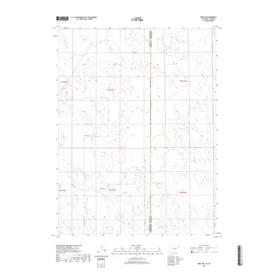
2019 Map of Wray NE
USGS Topo · Published 2019About this map
Yuma County and Dundy County meet along the border of Colorado and Nebraska in this high plains landscape. The terrain is defined by a rhythmic pattern of depressions and low ridges typical of the sandhills region, where section lines and county roads provide the primary framework for navigation. The survey documents the sparse infrastructure of the 2010s, where the rural grid is maintained through routes like Co Rd 46 and Co Rd 55. This area, divided among townships t3n r42w and t2n r43w, reflects the long-standing land divisions that have governed agricultural use since the initial settlement. The map serves as a precise record of the intermittent water features and natural contours that dictate the placement of ranch access roads such as Co Rd PP 51 10.
Find a feature on this map
12 named features on this map. Tap any name to fly to it.
Don’t see what you’re looking for? This feature index may not catch every label — zoom into the map to look around manually.
Map Details
Editions of this 2019 Wray NE Map
This is the sole edition of this map. No revisions or reprints were ever made.
Other maps of this area

1954 · Sterling
USGS Topo · 1:250,000

1954 · McCook
USGS Topo · 1:250,000

1957 · McCook
USGS Topo · 1:250,000

1958 · McCook
USGS Topo · 1:250,000

1958 · Sterling
USGS Topo · 1:250,000
1961 · Haigler
USGS Topo · 1:24,000

1961 · Laird
USGS Topo · 1:24,000

1961 · Wray
USGS Topo · 1:24,000

1971 · Alvin SW
USGS Topo · 1:24,000

1971 · Alvin
USGS Topo · 1:24,000