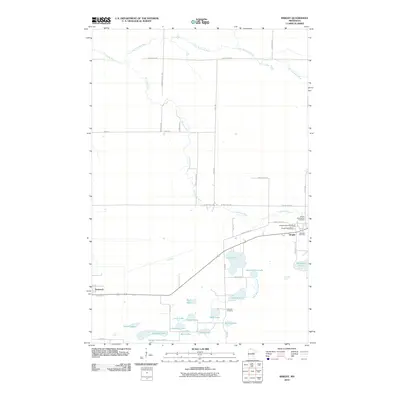
2010 Map of Wright
USGS Topo · Published 2010About this map
Wright serves as a central hub in this section of Carlton County, where the Tamarack River and West Branch Kettle River systems shape the landscape. The town is marked by several local institutions, including the Wright Post Office and multiple burial grounds such as Wright Community Cemetery, Wright Catholic Cemetery, and Lakeview Cemetery. The settlement pattern reflects the importance of water resources, with a dense cluster of lakes to the south including Kettle Lake, School Lake, and Mattila Lake.
Find a feature on this map
46 named features on this map. Tap any name to fly to it.
Don’t see what you’re looking for? This feature index may not catch every label — zoom into the map to look around manually.
Map Details
Editions of this 2010 Wright Map
This is the sole edition of this map. No revisions or reprints were ever made.
Other maps of this area

1953 · Duluth
USGS Topo · 1:250,000

1958 · Duluth
USGS Topo · 1:250,000

1961 · Cromwell
USGS Topo · 1:62,500

1963 · Prairie Lake
USGS Topo · 1:24,000

1969 · Automba
USGS Topo · 1:24,000

1969 · Lawler
USGS Topo · 1:24,000

1970 · Tamarack
USGS Topo · 1:24,000

1970 · Little Prairie Lake
USGS Topo · 1:24,000

1970 · Balsam
USGS Topo · 1:24,000

1970 · Wright
USGS Topo · 1:24,000