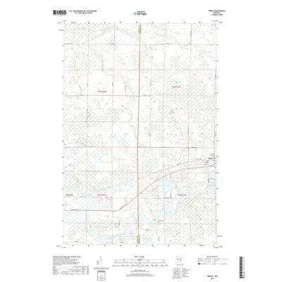
2019 Map of Wright
USGS Topo · Published 2019About this map
Wright and Tamarack anchor this 2019 survey of the marshy landscape straddling the border of Aitkin and Carlton Counties. The region is defined by an intricate network of wetlands and small glacial lakes, including Cole Lake, Tamarack Lake, and Walli Lake. The Tamarack River and Little Tamarack River meander through the northern and central sections, providing a glimpse into the drainage patterns of this peatland-rich environment. For genealogists and local historians, the map is remarkably dense with burial sites concentrated near the settlement of Wright, such as the Wright Community Cem, Wright Catholic Cem, and Lakeview Cem, alongside the more isolated Lakeside Cem further west. The landscape is interconnected by a grid of rural routes like N Finn Rd and Mattila Rd, reflecting the scattered agricultural and residential homesteads that have persisted in this north-central Minnesota terrain.
Find a feature on this map
60 named features on this map. Tap any name to fly to it.
Don’t see what you’re looking for? This feature index may not catch every label — zoom into the map to look around manually.
Map Details
Editions of this 2019 Wright Map
This is the sole edition of this map. No revisions or reprints were ever made.
Other maps of this area

1953 · Duluth
USGS Topo · 1:250,000

1958 · Duluth
USGS Topo · 1:250,000

1961 · Cromwell
USGS Topo · 1:62,500

1963 · Prairie Lake
USGS Topo · 1:24,000

1969 · Automba
USGS Topo · 1:24,000

1969 · Lawler
USGS Topo · 1:24,000

1970 · Tamarack
USGS Topo · 1:24,000

1970 · Little Prairie Lake
USGS Topo · 1:24,000

1970 · Balsam
USGS Topo · 1:24,000

1970 · Wright
USGS Topo · 1:24,000