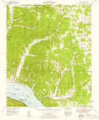
1953 Map of Wright
USGS Topo · Published 1958About this map
Pickwick Lake and the Tennessee River define the southern reaches of this Alabama landscape, marking the border between Lauderdale and Colbert counties. The terrain is characterized by a series of deep hollows named for early families, including Beckham Hollow, Lester Hollow, and Spain Hollow, which drain toward the river through Brush Creek and Bluff Creek. Small communities and spiritual centers such as Wright and Murphy Cross Roads anchor the uplands, supported by country churches like Williams Chapel and Murphy Chapel.
Find a feature on this map
49 named features on this map. Tap any name to fly to it.
Don’t see what you’re looking for? This feature index may not catch every label — zoom into the map to look around manually.
Map Details
Editions of this 1953 Wright Map
3 editions found
Other maps of this area

1905 · Waynesboro
USGS Topo · 1:125,000

1911 · Iuka
USGS Topo · 1:48,000

1914 · Iuka
USGS Topo · 1:62,500

1924 · Gravelly Springs
USGS Topo · 1:48,000

1926 · Gravelly Springs
USGS Topo · 1:62,500

1935 · Cherokee
USGS Topo · 1:24,000

1935 · Wright
USGS Topo · 1:24,000

1936 · Margerum
USGS Topo · 1:24,000

1936 · Waterloo
USGS Topo · 1:24,000

1936 · Threet
USGS Topo · 1:24,000