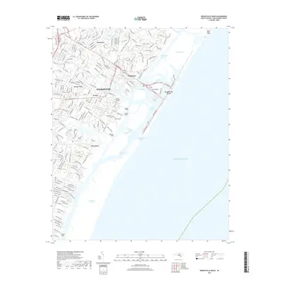
2019 Map of Wrightsville Beach
USGS Topo · Published 2019About this map
Wrightsville Beach and the barrier islands of New Hanover County define this coastal landscape, where the Atlantic shoreline meets a complex network of tidal sounds and channels. Modern infrastructure and residential development extend eastward from Wilmington through communities like Winter Park and Seagate, crossing the Intracoastal Waterway via Harbor Island. The map meticulously details the transit corridors of Military Cutoff Rd and Wrightsville Ave, reflecting the dense suburbanization that has transformed the mainland areas of Masonboro and Windemere.
Find a feature on this map
44 named features on this map. Tap any name to fly to it.
Don’t see what you’re looking for? This feature index may not catch every label — zoom into the map to look around manually.
Map Details
Editions of this 2019 Wrightsville Beach Map
This is the sole edition of this map. No revisions or reprints were ever made.
Other maps of this area

1942 · Topsail
USGS Topo · 1:62,500

1942 · Wilmington
USGS Topo · 1:62,500

1947 · Rocky Point
USGS Topo · 1:62,500

1948 · Topsail
USGS Topo · 1:62,500

1948 · Wilmington
USGS Topo · 1:62,500

1953 · Beaufort
USGS Topo · 1:250,000

1954 · Beaufort
USGS Topo · 1:250,000

1970 · Hampstead
USGS Topo · 1:24,000
1970 · Wrightsville Beach
USGS Topo · 1:24,000
1970 · Carolina Beach
USGS Topo · 1:24,000
Featured Places
- Wilmington, NC
- Wrightsville Beach, NC
- Wrightsville, Wilmington
- Airlie, Wilmington
- Channel Acres, Wrightsville Beach