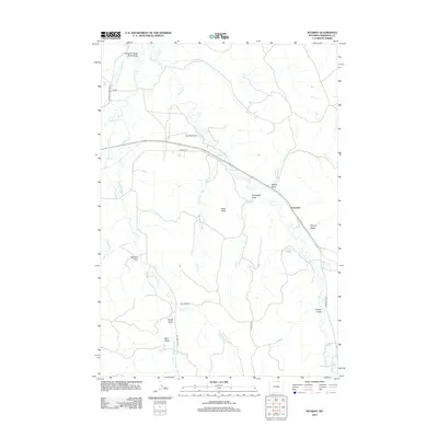
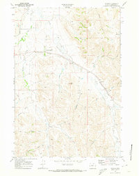
2012 Map of Wyarno
USGS Topo · Published 2012About this map
Wyarno serves as the primary settlement hub in this portion of Sheridan County, situated along a prominent local roadway that cuts through a complex network of ephemeral drainages and irrigation infrastructure. The landscape is defined by its water management systems, including Ninemile Ditch, Prairie Dog Ditch Number 13, and Prairie Dog Ditch Number 11, which redirect the flow of Prairie Dog Cr to support the surrounding ranchland. Numerous family-named landmarks are scattered across the terrain, with Fields Draw, Dawson Draw, and Helvey Draw providing evidence of local historical land use and early settlement patterns. This topographic study also highlights Symons Airport and the high point of Hazel Peak, illustrating how human infrastructure like Wildcat Rd navigates the undulating drainages of Dutch Cr and Wildcat Cr.
Find a feature on this map
26 named features on this map. Tap any name to fly to it.
Don’t see what you’re looking for? This feature index may not catch every label — zoom into the map to look around manually.
Map Details
Editions of this 2012 Wyarno Map
This is the sole edition of this map. No revisions or reprints were ever made.
Other maps of this area

1909 · Sheridan
USGS Topo · 1:125,000

1911 · Sheridan
USGS Topo · 1:125,000

1955 · Sheridan
USGS Topo · 1:250,000

1958 · Sheridan
USGS Topo · 1:250,000

1962 · Sheridan
USGS Topo · 1:250,000

1967 · Buffalo Run Creek
USGS Topo · 1:24,000
1967 · Big Horn
USGS Topo · 1:24,000
1968 · Sheridan
USGS Topo · 1:24,000
1968 · Bar N Draw
USGS Topo · 1:24,000
1968 · Wyarno
USGS Topo · 1:24,000