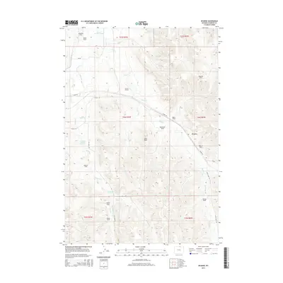
2015 Map of Wyarno
USGS Topo · Published 2015About this map
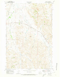
Dutch Cr and Wildcat Cr drain a high plains landscape marked by an extensive system of water management features in this modern topographic record. The settlement of Wyarno serves as a small hub, situated where Wyarno Rd intersects with the seasonal drainages of Wyarno Draw and Negro Draw. Irrigation is central to the area's geography, evidenced by labels like Prairie Dog Ditch Number 11 and the Ninemile Ditch, which redirect water across the varied topography of Hazel Peak and Dawson Draw. Numerous named reservoirs, including the Kahn Reservoir and Hape Reservoir, underscore the efforts to capture runoff in this semi-arid region. Symons Airport provides local aviation access, while a network of rural routes such as Cat Creek Rd and Ulm Rd connect isolated ranching and agricultural operations throughout the Wyoming interior.
Find a feature on this map
40 named features on this map. Tap any name to fly to it.
Don’t see what you’re looking for? This feature index may not catch every label — zoom into the map to look around manually.
Map Details
Editions of this 2015 Wyarno Map
This is the sole edition of this map. No revisions or reprints were ever made.
Other maps of this area

1909 · Sheridan
USGS Topo · 1:125,000

1911 · Sheridan
USGS Topo · 1:125,000

1955 · Sheridan
USGS Topo · 1:250,000

1958 · Sheridan
USGS Topo · 1:250,000

1962 · Sheridan
USGS Topo · 1:250,000

1967 · Buffalo Run Creek
USGS Topo · 1:24,000
1967 · Big Horn
USGS Topo · 1:24,000
1968 · Sheridan
USGS Topo · 1:24,000
1968 · Bar N Draw
USGS Topo · 1:24,000
1968 · Wyarno
USGS Topo · 1:24,000