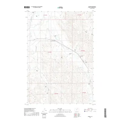
2017 Map of Wyarno
USGS Topo · Published 2017About this map
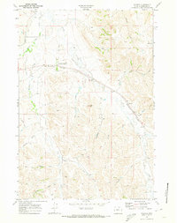
Wyarno serves as the central hub of this eastern Sheridan County landscape, where the high plains of northern Wyoming are defined by an intricate network of irrigation and drainage. The significance of water rights and ranching infrastructure is evident in the presence of the Prairie Dog Ditch Number 13 and Ninemile Ditch, which redirect flow across the arid terrain. The map captures a topography carved by numerous named coulees, including Wyarno Draw and Eyechaner Draw, which lead toward Dutch Cr. To the west, the prominent Hazel Peak rises above the surrounding draws. Transport through the region follows historical corridors like the Wyarno Rd and Sheridan-Ulm-Clearmont Rd, while the presence of Symons Airport reflects the continued reliance on small-scale aviation to navigate this expansive ranchland.
Find a feature on this map
36 named features on this map. Tap any name to fly to it.
Don’t see what you’re looking for? This feature index may not catch every label — zoom into the map to look around manually.
Map Details
Editions of this 2017 Wyarno Map
This is the sole edition of this map. No revisions or reprints were ever made.
Other maps of this area

1909 · Sheridan
USGS Topo · 1:125,000

1911 · Sheridan
USGS Topo · 1:125,000

1955 · Sheridan
USGS Topo · 1:250,000

1958 · Sheridan
USGS Topo · 1:250,000

1962 · Sheridan
USGS Topo · 1:250,000

1967 · Buffalo Run Creek
USGS Topo · 1:24,000
1967 · Big Horn
USGS Topo · 1:24,000
1968 · Sheridan
USGS Topo · 1:24,000
1968 · Bar N Draw
USGS Topo · 1:24,000
1968 · Wyarno
USGS Topo · 1:24,000