1980 Map of Wyoming Peak
USGS Topo · Published 1980About this map
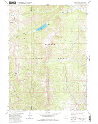
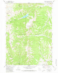
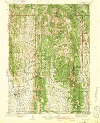
Wyoming Peak and the high ridges of the Wyoming Range dominate this 1980 survey, illustrating a landscape defined by dramatic elevation and a network of remote alpine trails. The terrain within the Bridger National Forest is characterized by the headwaters of numerous drainages, including the complex forks of Middle Piney Creek and Coal Creek. A notable historical detail is the lone Grave located near the southern boundary, a quiet marker of the human presence in this high-altitude wilderness. The map provides clear documentation of back-country infrastructure, featuring sites like Sacajawea Campground and the Middle Piney Pack Trail. For those interested in geomorphology or recreation, the survey details landmarks such as Wakelo Falls and the secluded Middle Piney Lake, which is reached via several pack trails that navigate through Cheese Pass and along Darby Mountain.
Find a feature on this map
32 named features on this map. Tap any name to fly to it.
Don’t see what you’re looking for? This feature index may not catch every label — zoom into the map to look around manually.
Map Details
Editions of this 1980 Wyoming Peak Map
2 editions found
Other maps of this area

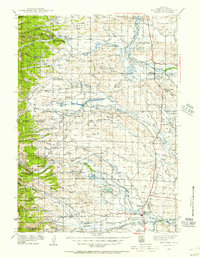
1921 · Afton
USGS Topo · 1:125,000
1936 · Cokeville
USGS Topo · 1:96,000
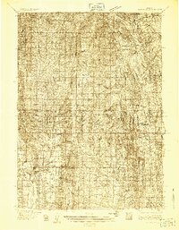
1939 · Big Piney
USGS Topo · 1:125,000
1942 · Cokeville
USGS Topo · 1:125,000
1942 · Big Piney
USGS Topo · 1:125,000

1955 · Preston
USGS Topo · 1:250,000

1958 · Preston
USGS Topo · 1:250,000

1962 · Preston
USGS Topo · 1:250,000
1967 · Graham Peak
USGS Topo · 1:24,000
1967 · Mount Thompson
USGS Topo · 1:24,000