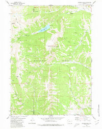
1980 Map of Wyoming Peak
USGS Topo · Published 1980About this map
Wyoming Peak and the high ridges of the Wyoming Range dominate this 1980 survey of the Bridger National Forest. The landscape is defined by the headwaters of the Piney Creek system, where the Middle Piney Lake sits below steep slopes. A network of pack trails, including the Middle Piney Trail and Fish Creek Trail, provides the primary access through this high-elevation terrain, crossing over points like Cheese Pass Springs. The map reveals the quiet infrastructure of the national forest during the late 1970s, featuring the Sacajawea Campground and a remote Cem Grave near South Piney Creek. The border between Lincoln and Sublette counties bisects the rugged topography, which is carved by numerous drainages such as Delight Creek and Prospect Canyon Creek.
Find a feature on this map
31 named features on this map. Tap any name to fly to it.
Don’t see what you’re looking for? This feature index may not catch every label — zoom into the map to look around manually.
Map Details
Editions of this 1980 Wyoming Peak Map
2 editions found
Other maps of this area

1921 · Afton
USGS Topo · 1:125,000

1936 · Cokeville
USGS Topo · 1:96,000

1939 · Big Piney
USGS Topo · 1:125,000

1942 · Cokeville
USGS Topo · 1:125,000

1942 · Big Piney
USGS Topo · 1:125,000

1955 · Preston
USGS Topo · 1:250,000

1958 · Preston
USGS Topo · 1:250,000

1962 · Preston
USGS Topo · 1:250,000

1967 · Graham Peak
USGS Topo · 1:24,000

1967 · Mount Thompson
USGS Topo · 1:24,000