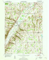
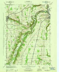
1951 Map of Wyoming
USGS Topo · Published 1951About this map
The Wyoming Valley dominates this 1951 survey, where the winding path of Oatka Creek carves a deep corridor through the western New York landscape. This area reflects a mid-century rural economy defined by small crossroads settlements and local industries, most notably the Pioneer Salt Well located near the village of Wyoming. The transition from upland farming to valley-bottom infrastructure is evident in the dense network of named roads like Roanoke Road and Gulf Road, which connect a series of small, family-named locales including Lambs Corner and Spragues Corner.
Find a feature on this map
63 named features on this map. Tap any name to fly to it.
Don’t see what you’re looking for? This feature index may not catch every label — zoom into the map to look around manually.
Map Details
Editions of this 1951 Wyoming Map
4 editions found
Other maps of this area

1904 · Batavia
USGS Topo · 1:62,500

1904 · Caledonia
USGS Topo · 1:62,500

1905 · Portage
USGS Topo · 1:62,500

1905 · Nunda
USGS Topo · 1:62,500

1943 · Mount Morris
USGS Topo · 1:24,000

1943 · Warsaw
USGS Topo · 1:24,000

1943 · Castile
USGS Topo · 1:24,000
1944 · Mount Morris
USGS Topo · 1:31,680

1944 · Stafford
USGS Topo · 1:31,680

1944 · Warsaw
USGS Topo · 1:31,680