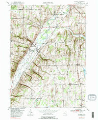
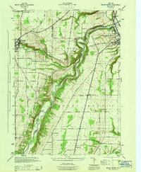
1951 Map of Wyoming
USGS Topo · Published 1989About this map
Oatka Creek carves a deep valley through the center of this Wyoming County landscape, where the village of Wyoming sits at the base of the western hills. The map captures an era of post-war agricultural stability, where the economy was rooted in the land, evident by features like the Pioneer Salt Well and several gravel pits. Settlement patterns follow the winding creek and the primary roads, branching out from small hubs like Covington and Pearl Creek. Local education and faith are represented by landmarks such as Central School, School No 10, and St Marys Cem. The varied elevation is punctuated by prominent rises like Titus Hill and Pikes Peak, while the southeastern corner touches the edge of Lake Le Roy. This survey provides a clear view of the rural infrastructure of western New York before significant modern development altered the historic road networks.
Find a feature on this map
82 named features on this map. Tap any name to fly to it.
Don’t see what you’re looking for? This feature index may not catch every label — zoom into the map to look around manually.
Map Details
Editions of this 1951 Wyoming Map
4 editions found
Other maps of this area

1904 · Batavia
USGS Topo · 1:62,500

1904 · Caledonia
USGS Topo · 1:62,500

1905 · Portage
USGS Topo · 1:62,500

1905 · Nunda
USGS Topo · 1:62,500

1943 · Mount Morris
USGS Topo · 1:24,000

1943 · Warsaw
USGS Topo · 1:24,000

1943 · Castile
USGS Topo · 1:24,000
1944 · Mount Morris
USGS Topo · 1:31,680

1944 · Stafford
USGS Topo · 1:31,680

1944 · Warsaw
USGS Topo · 1:31,680