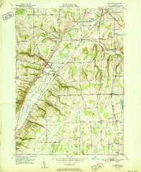
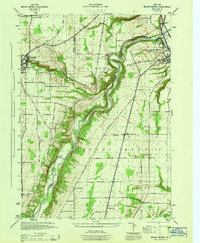
1951 Map of Wyoming
USGS Topo · Published 1951About this map
Oatka Creek carves a significant path through the Wyoming Valley, where the 1951 landscape reveals a distinct transition from agricultural plateaus to industrial and transit corridors. The Baltimore and Ohio RR runs parallel to the creek, serving the village of Wyoming and the southern edge of Saltvale. A noteworthy historical marker is the Pioneer Salt Well located near Cascade Brook, signaling the region's mineral history. Small rural centers like Covington and Pearl Creek anchor the eastern hills, connected by a network of family-named routes such as Durfee Road and Dodson Road. These roads frequently lead to community landmarks, including the St Marys Ch and its adjacent St Marys Cem. The map further documents educational infrastructure from a passing era, such as School No 10 and the Central School, while preserving natural features like Cascade Falls and the deep incision of the Gulf.
Find a feature on this map
83 named features on this map. Tap any name to fly to it.
Don’t see what you’re looking for? This feature index may not catch every label — zoom into the map to look around manually.
Map Details
Editions of this 1951 Wyoming Map
4 editions found
Other maps of this area

1904 · Batavia
USGS Topo · 1:62,500

1904 · Caledonia
USGS Topo · 1:62,500

1905 · Portage
USGS Topo · 1:62,500

1905 · Nunda
USGS Topo · 1:62,500

1943 · Mount Morris
USGS Topo · 1:24,000

1943 · Warsaw
USGS Topo · 1:24,000

1943 · Castile
USGS Topo · 1:24,000
1944 · Mount Morris
USGS Topo · 1:31,680

1944 · Stafford
USGS Topo · 1:31,680

1944 · Warsaw
USGS Topo · 1:31,680