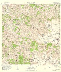
1960 Map of Yabucoa
USGS Topo · Published 1961About this map
The Valle de Yabucoa dominates the southeastern coast of Puerto Rico in this mid-century survey, revealing a landscape defined by industrial agriculture and clustered settlements. The prominent Central Roig sugar mill stands as a central economic landmark near the urban core of Yabucoa, linked to the surrounding coastal plains and the Cano de Santiago. The terrain rises sharply from the alluvial flats into the Sierra de Panduras, where peaks like Cerro La Pandura provide a dramatic backdrop to the coastal communities.
Find a feature on this map
62 named features on this map. Tap any name to fly to it.
Don’t see what you’re looking for? This feature index may not catch every label — zoom into the map to look around manually.
Map Details
Editions of this 1960 Yabucoa Map
3 editions found
Other maps of this area

1945 · Punta Tuna
USGS Topo · 1:30,000

1946 · Patillas
USGS Topo · 1:30,000

1946 · Humacao
USGS Topo · 1:30,000

1946 · Punta Guayanes
USGS Topo · 1:30,000

1946 · Juncos
USGS Topo · 1:30,000

1946 · Yabucoa
USGS Topo · 1:30,000

1946 · Guayama
USGS Topo · 1:30,000

1946 · Caguas
USGS Topo · 1:30,000
1947 · Humacao SO
USGS Topo · 1:10,000

1947 · Yabucoa SO
USGS Topo · 1:10,000