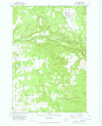
1971 Map of Yacolt
USGS Topo · Published 1973About this map
Yacolt sits at the northern edge of this Clark County landscape, where the Portland and Northern RR tracks follow the winding path of the East Fork Lewis River. This 1971 field-checked survey captures the rural character of southwestern Washington just as modern infrastructure was beginning to define the timber-heavy terrain. The map records several distinct waterfalls including Lucia Falls, Moulton Falls, and Yacolt Falls, reflecting a landscape deeply shaped by its hydrology.
Find a feature on this map
42 named features on this map. Tap any name to fly to it.
Don’t see what you’re looking for? This feature index may not catch every label — zoom into the map to look around manually.
Map Details
Editions of this 1971 Yacolt Map
2 editions found

Other maps of this area

1897 · Portland
USGS Topo · 1:62,500

1905 · Portland
USGS Topo · 1:62,500

1918 · Troutdale
USGS Topo · 1:62,500

1934 · Troutdale
USGS Topo · 1:48,000

1940 · Portland
USGS Topo · 1:62,500

1940 · La Center
USGS Topo · 1:62,500

1941 · Yacolt
USGS Topo · 1:62,500

1941 · Camas
USGS Topo · 1:62,500

1942 · Camas
USGS Topo · 1:62,500

1948 · Vancouver
USGS Topo · 1:250,000