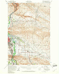
1953 Map of Yakima East
USGS Topo · Published 1961About this map
The Yakima River serves as the central artery for this mid-century landscape, where industrial infrastructure and agricultural expansion meet. On the eastern bank, the sprawling Yakima Firing Center Military Reservation occupies the high ground of Umtanum Ridge, complete with drone strips and an abandoned landing field. In the valley below, the intricate irrigation network of the Roza Canal and Selah Canal supports a grid of rural homesteads and family farms, many connected by roads named for local families such as Laframboise Road and Beauchene Rd.
Find a feature on this map
63 named features on this map. Tap any name to fly to it.
Don’t see what you’re looking for? This feature index may not catch every label — zoom into the map to look around manually.
Map Details
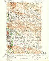
Editions of this 1953 Yakima East Map

Other maps of this area

1899 · Ellensburg
USGS Topo · 1:125,000

1901 · Ellensburg
USGS Topo · 1:125,000

1910 · Zillah
USGS Topo · 1:125,000

1936 · Yakima East
USGS Topo · 1:48,000

1936 · Hog Ranch Buttes
USGS Topo · 1:48,000

1937 · White Swan
USGS Topo · 1:125,000

1938 · Badger Pocket
USGS Topo · 1:48,000

1939 · Boylston
USGS Topo · 1:48,000

1941 · Black Rock Spring
USGS Topo · 1:62,500

1941 · Yakima East
USGS Topo · 1:62,500