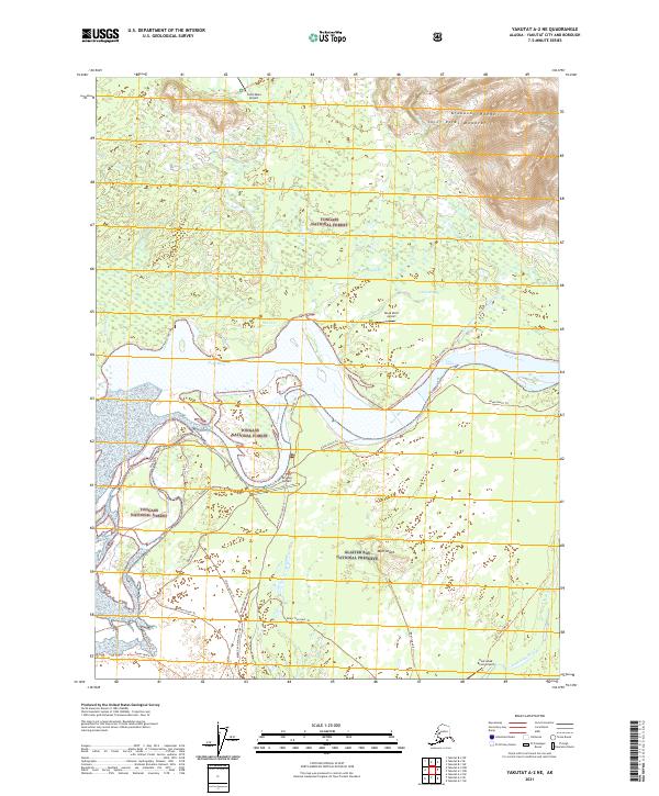
2021 Map of Yakutat A-2 NE
USGS Topo · Published 2021About this map
Tongass National Forest and Glacier Bay National Preserve meet along a complex network of glacial outwash channels and river plains. The Alsek River serves as the central drainage, flowing past First Rapids and diverging into various sloughs and tributaries like Shack Cr and Cabin Slough. This coastal landscape is defined by its transition from the high peaks of the Saint Elias Mountains and Brabazon Range down to the braided wetlands of the river delta.
Find a feature on this map
41 named features on this map. Tap any name to fly to it.
Don’t see what you’re looking for? This feature index may not catch every label — zoom into the map to look around manually.
Map Details
Editions of this 2021 Yakutat A-2 NE Map
This is the sole edition of this map. No revisions or reprints were ever made.
Other maps of this area

1951 · Yakutat
USGS Topo · 1:250,000

1959 · Yakutat A-1
USGS Topo · 1:63,360

1959 · Yakutat A-2
USGS Topo · 1:63,360

1959 · Yakutat B-2
USGS Topo · 1:63,360

1959 · Yakutat B-1
USGS Topo · 1:63,360

1959 · Yakutat
USGS Topo · 1:250,000

1997 · Yakutat B-1
USGS Topo · 1:63,360
2017 · Yakutat A-1 NW
USGS Topo · 1:25,000
2017 · Yakutat A-1 SW
USGS Topo · 1:25,000
2017 · Yakutat A-2 NW
USGS Topo · 1:25,000