
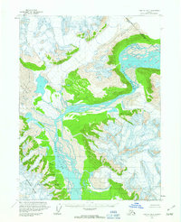
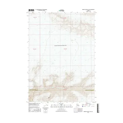
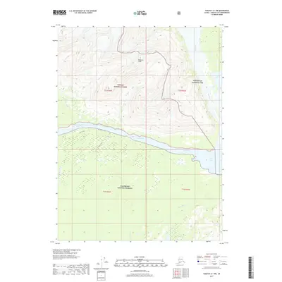
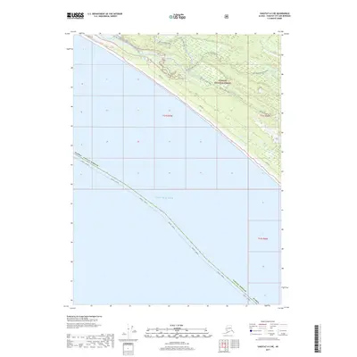
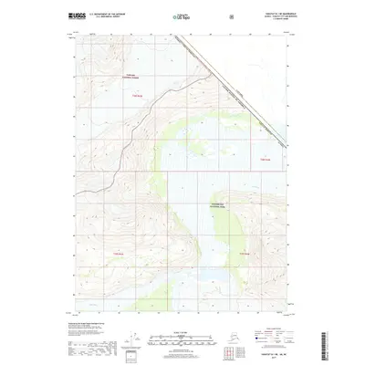
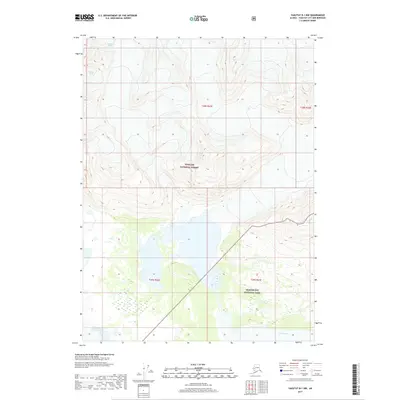
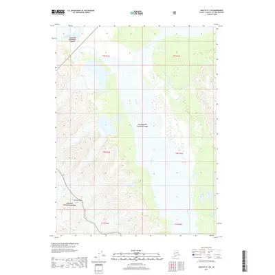
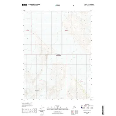
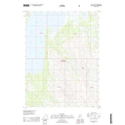
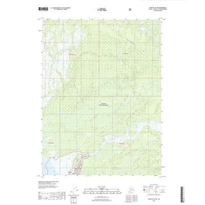
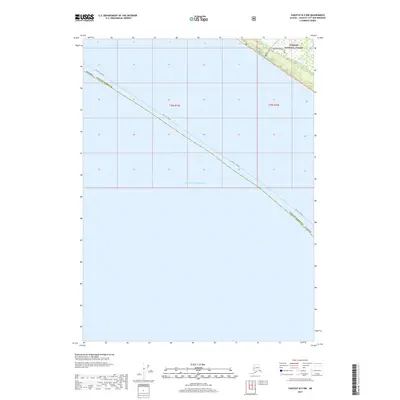
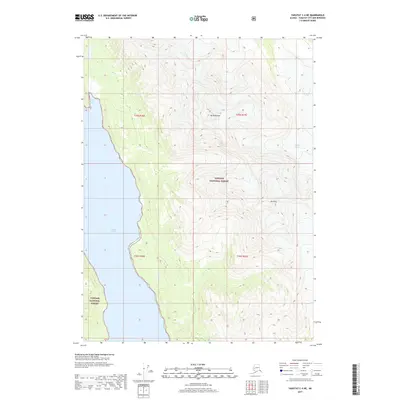
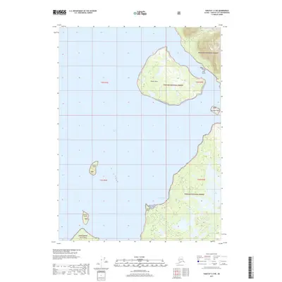
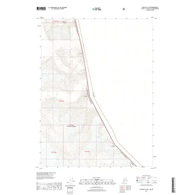
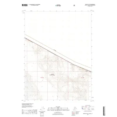
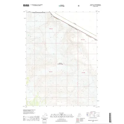
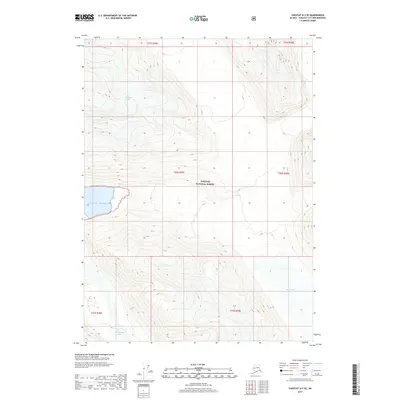
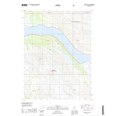
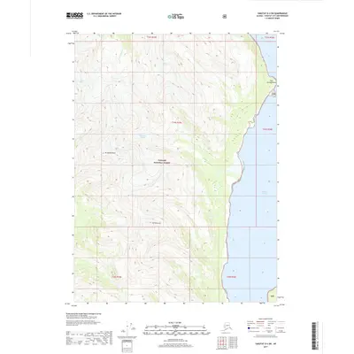
1959 Map of Yakutat B-1
USGS Topo · Published 1977About this map
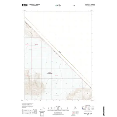
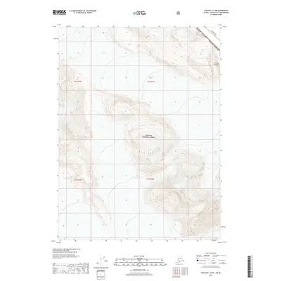
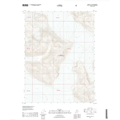
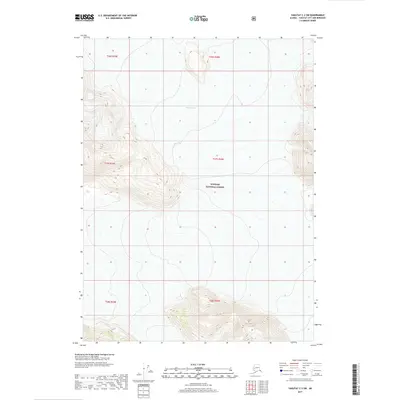
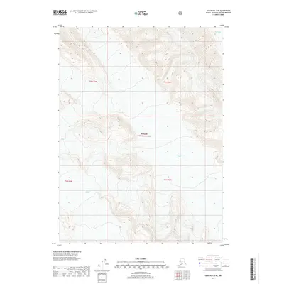
The Alsek River dominates this landscape, carving a wide braided path through the coastal mountains of Southeast Alaska as it appeared during mid-century surveys. This territory, situated within the Tongass National Forest, highlights the intersection of the Brabazon Range and the massive Novatak Glacier, where numerous crevasses are documented across the ice fields. The map provides a detailed look at the international border, showing the Canada United States line and the British Columbia Alaska boundary, including segments marked as an Indefinite Boundary. The lack of roads or trails on this 1959 sheet reflects the extreme isolation of this glacial corridor before modern development, focusing instead on the raw physical geography of the river and its surrounding peaks.
Find a feature on this map
8 named features on this map. Tap any name to fly to it.
Don’t see what you’re looking for? This feature index may not catch every label — zoom into the map to look around manually.
Map Details
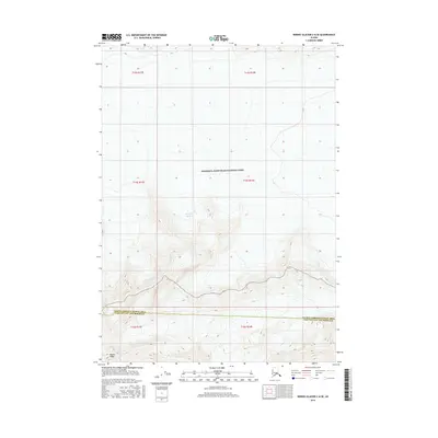
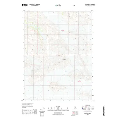
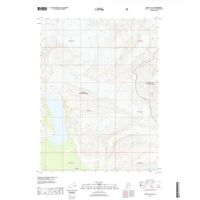
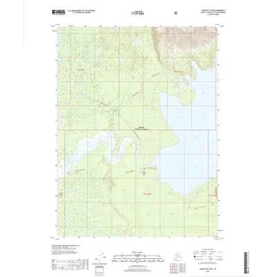
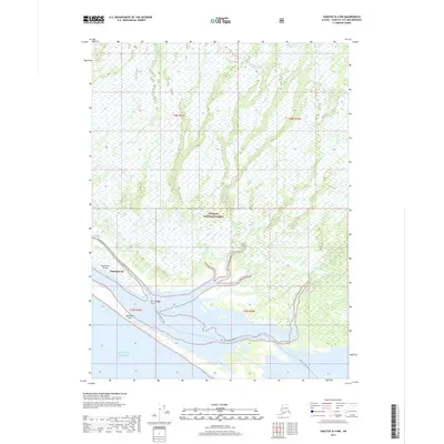
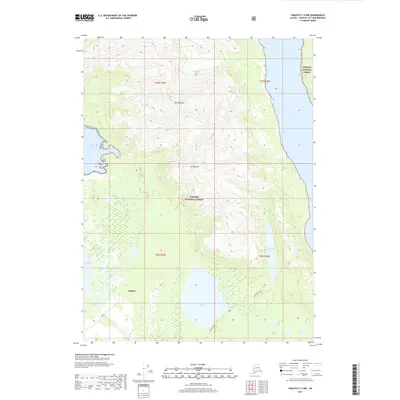
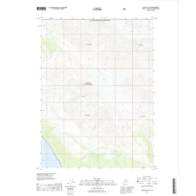
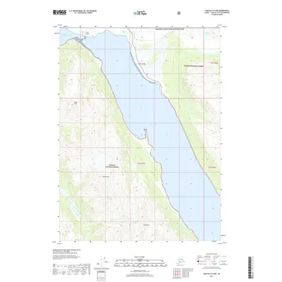
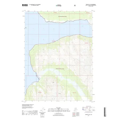
Editions of this 1959 Yakutat B-1 Map
2 editions found
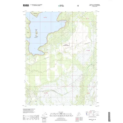
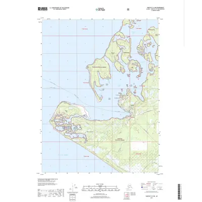
Historical Maps of United States Through Time
343 maps found

1948 Bering Glacier A-4
Yakutat Borough, AK

1948 Icy Bay D-2 and D-3
Yakutat Borough, AK

1950 Bering Glacier A-3
Yakutat Borough, AK

1950 Bering Glacier
Yakutat Borough, AK

1950 Icy Bay
Yakutat Borough, AK

1951 Bering Glacier A-2
Yakutat Borough, AK

1951 Bering Glacier A-4
Yakutat Borough, AK

1951 Bering Glacier
Yakutat Borough, AK

1951 Icy Bay D-2 and D-3
Yakutat Borough, AK

1951 Icy Bay
Yakutat Borough, AK

1951 Mt Saint Elias
Yakutat Borough, AK

1959 Bering Glacier A-2
Yakutat Borough, AK

1959 Bering Glacier A-3
Yakutat Borough, AK

1959 Bering Glacier A-4
Yakutat Borough, AK

1959 Bering Glacier
Yakutat Borough, AK

1959 Icy Bay D-2 and D-3
Yakutat Borough, AK

1959 Mt Saint Elias
Yakutat Borough, AK

1959 Yakutat A-1
Yakutat Borough, AK

1959 Yakutat A-2
Yakutat Borough, AK

1959 Yakutat A-3
Yakutat Borough, AK
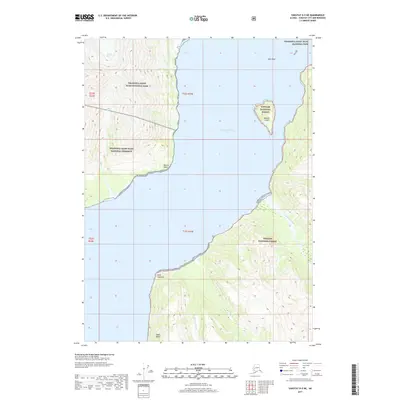
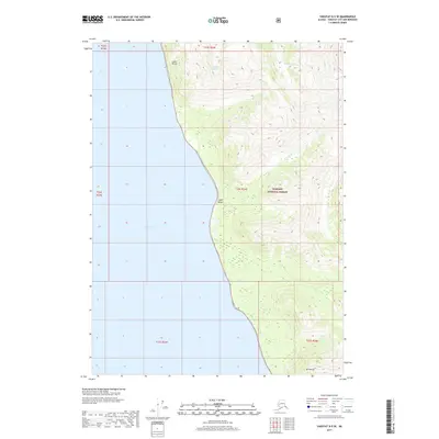
1959 Yakutat B-1
Yakutat Borough, AK

1959 Yakutat B-2
Yakutat Borough, AK

1959 Yakutat B-3
Yakutat Borough, AK

1959 Yakutat B-4
Yakutat Borough, AK

1959 Yakutat B-5
Yakutat Borough, AK

1959 Yakutat C-3
Yakutat Borough, AK

1959 Yakutat C-4
Yakutat Borough, AK

1959 Yakutat C-5
Yakutat Borough, AK

1959 Yakutat D-3
Yakutat Borough, AK

1959 Yakutat D-4
Yakutat Borough, AK

1959 Yakutat D-5
Yakutat Borough, AK

1961 Icy Bay
Yakutat Borough, AK

1961 Mount Fairweather D-6
Yakutat Borough, AK

1961 Mount Fairweather D-7
Yakutat Borough, AK

1961 Skagway A-7
Yakutat Borough, AK

1961 Skagway A-8
Yakutat Borough, AK

1961 Skagway B-8
Yakutat Borough, AK

1984 Bering Glacier A-4
Yakutat Borough, AK

1984 Bering Glacier A-5
Yakutat Borough, AK

1984 Bering Glacier A-6
Yakutat Borough, AK

1984 Bering Glacier A-7
Yakutat Borough, AK

1984 Bering Glacier A-8
Yakutat Borough, AK

1985 Bering Glacier A-1
Yakutat Borough, AK

1985 Bering Glacier B-1
Yakutat Borough, AK

1985 Bering Glacier B-2
Yakutat Borough, AK

1985 Bering Glacier B-3
Yakutat Borough, AK

1985 Bering Glacier B-4
Yakutat Borough, AK

1985 Bering Glacier B-5
Yakutat Borough, AK

1985 Bering Glacier B-6
Yakutat Borough, AK

1985 Bering Glacier B-7
Yakutat Borough, AK

1985 Bering Glacier C-3
Yakutat Borough, AK

1985 Bering Glacier C-4
Yakutat Borough, AK

1985 Bering Glacier C-5
Yakutat Borough, AK

1985 Bering Glacier C-6
Yakutat Borough, AK

1985 Icy Bay D-1
Yakutat Borough, AK

1985 Mount Saint Elias A-3
Yakutat Borough, AK

1985 Mount Saint Elias A-4
Yakutat Borough, AK

1985 Mount Saint Elias A-5
Yakutat Borough, AK

1985 Mount Saint Elias A-6
Yakutat Borough, AK

1985 Mount Saint Elias A-7
Yakutat Borough, AK

1985 Mount Saint Elias A-8
Yakutat Borough, AK

1985 Mount Saint Elias B-3
Yakutat Borough, AK

1985 Mount Saint Elias B-4
Yakutat Borough, AK

1985 Mount Saint Elias B-5
Yakutat Borough, AK

1985 Mount Saint Elias B-7
Yakutat Borough, AK

1985 Mount Saint Elias B-8
Yakutat Borough, AK

1985 Yakutat C-1
Yakutat Borough, AK

1985 Yakutat C-2
Yakutat Borough, AK

1985 Yakutat C-6
Yakutat Borough, AK

1985 Yakutat C-7
Yakutat Borough, AK

1985 Yakutat C-8
Yakutat Borough, AK

1985 Yakutat D-2
Yakutat Borough, AK

1985 Yakutat D-6
Yakutat Borough, AK

1985 Yakutat D-7
Yakutat Borough, AK

1985 Yakutat D-8
Yakutat Borough, AK

1987 Yakutat B-4 NW
Yakutat Borough, AK

1987 Yakutat B-5 NE
Yakutat Borough, AK

1987 Yakutat C-4 SE
Yakutat Borough, AK

1987 Yakutat C-4 SW
Yakutat Borough, AK

1987 Yakutat C-5 SE
Yakutat Borough, AK

1987 Yakutat C-5 SW
Yakutat Borough, AK

1996 Yakutat C-5
Yakutat Borough, AK

1997 Yakutat B-1
Yakutat Borough, AK

1997 Yakutat C-4
Yakutat Borough, AK

2014 Bering Glacier A-8 NE
Yakutat Borough, AK

2014 Bering Glacier A-8 OE S NW
Yakutat Borough, AK

2014 Bering Glacier A-8 SE
Yakutat Borough, AK

2014 Bering Glacier A-8 SW
Yakutat Borough, AK

2014 Bering Glacier B-6 NW
Yakutat Borough, AK

2014 Bering Glacier B-7 NE
Yakutat Borough, AK

2014 Bering Glacier C-6 SW
Yakutat Borough, AK

2016 Bering Glacier A-4 NE
Yakutat Borough, AK

2016 Bering Glacier A-4 NW
Yakutat Borough, AK

2016 Bering Glacier A-4 SE
Yakutat Borough, AK

2016 Bering Glacier A-4 SW
Yakutat Borough, AK

2016 Bering Glacier A-5 NE
Yakutat Borough, AK

2016 Bering Glacier A-5 NW
Yakutat Borough, AK

2016 Bering Glacier A-5 SE
Yakutat Borough, AK

2016 Bering Glacier A-5 SW
Yakutat Borough, AK

2016 Bering Glacier A-6 NE
Yakutat Borough, AK

2016 Bering Glacier A-6 NW
Yakutat Borough, AK

2016 Bering Glacier A-6 SE
Yakutat Borough, AK

2016 Bering Glacier A-6 SW
Yakutat Borough, AK

2016 Bering Glacier A-7 NE
Yakutat Borough, AK

2016 Bering Glacier A-7 NW
Yakutat Borough, AK

2016 Bering Glacier A-7 SE
Yakutat Borough, AK

2016 Bering Glacier A-7 SW
Yakutat Borough, AK

2016 Bering Glacier B-4 NE
Yakutat Borough, AK

2016 Bering Glacier B-4 NW
Yakutat Borough, AK

2016 Bering Glacier B-4 SE
Yakutat Borough, AK

2016 Bering Glacier B-4 SW
Yakutat Borough, AK

2016 Bering Glacier B-5 NE
Yakutat Borough, AK

2016 Bering Glacier B-5 NW
Yakutat Borough, AK

2016 Bering Glacier B-5 SE
Yakutat Borough, AK

2016 Bering Glacier B-5 SW
Yakutat Borough, AK

2016 Bering Glacier B-6 NE
Yakutat Borough, AK

2016 Bering Glacier B-6 SE
Yakutat Borough, AK

2016 Bering Glacier B-6 SW
Yakutat Borough, AK

2016 Bering Glacier B-7 SE
Yakutat Borough, AK

2016 Bering Glacier B-7 SW
Yakutat Borough, AK
2016 Bering Glacier C-4 SE
Yakutat Borough, AK
2016 Bering Glacier C-4 SW
Yakutat Borough, AK
2016 Bering Glacier C-5 SE
Yakutat Borough, AK
2016 Bering Glacier C-5 SW
Yakutat Borough, AK
2016 Bering Glacier C-6 SE
Yakutat Borough, AK

2017 Bering Glacier A-1 NE
Yakutat Borough, AK

2017 Bering Glacier A-1 NW
Yakutat Borough, AK

2017 Bering Glacier A-1 SE
Yakutat Borough, AK

2017 Bering Glacier A-1 SW
Yakutat Borough, AK

2017 Bering Glacier A-2 NE
Yakutat Borough, AK

2017 Bering Glacier A-2 NW
Yakutat Borough, AK

2017 Bering Glacier A-2 SE
Yakutat Borough, AK

2017 Bering Glacier A-2 SW
Yakutat Borough, AK

2017 Bering Glacier A-3 NE
Yakutat Borough, AK

2017 Bering Glacier A-3 NW
Yakutat Borough, AK

2017 Bering Glacier A-3 SE
Yakutat Borough, AK

2017 Bering Glacier A-3 SW
Yakutat Borough, AK

2017 Bering Glacier B-1 NE
Yakutat Borough, AK

2017 Bering Glacier B-1 NW
Yakutat Borough, AK

2017 Bering Glacier B-1 SE
Yakutat Borough, AK

2017 Bering Glacier B-1 SW
Yakutat Borough, AK

2017 Bering Glacier B-2 NE
Yakutat Borough, AK

2017 Bering Glacier B-2 NW
Yakutat Borough, AK

2017 Bering Glacier B-2 SE
Yakutat Borough, AK

2017 Bering Glacier B-2 SW
Yakutat Borough, AK

2017 Bering Glacier B-3 NE
Yakutat Borough, AK

2017 Bering Glacier B-3 NW
Yakutat Borough, AK

2017 Bering Glacier B-3 SE
Yakutat Borough, AK

2017 Bering Glacier B-3 SW
Yakutat Borough, AK
2017 Bering Glacier C-3 SE
Yakutat Borough, AK
2017 Bering Glacier C-3 SW
Yakutat Borough, AK

2017 Icy Bay D-1 NE
Yakutat Borough, AK

2017 Icy Bay D-1 NW
Yakutat Borough, AK

2017 Icy Bay D-1 SE
Yakutat Borough, AK

2017 Icy Bay D-1 SW
Yakutat Borough, AK

2017 Icy Bay D-2 NE
Yakutat Borough, AK

2017 Icy Bay D-2 NW
Yakutat Borough, AK

2017 Icy Bay D-2 SE
Yakutat Borough, AK

2017 Icy Bay D-3 NE
Yakutat Borough, AK

2017 Mount Fairweather D-5 NW
Yakutat Borough, AK

2017 Mount Fairweather D-6 NE
Yakutat Borough, AK

2017 Mount Fairweather D-6 NW
Yakutat Borough, AK

2017 Mount Fairweather D-6 SW
Yakutat Borough, AK

2017 Mount Fairweather D-7 NE
Yakutat Borough, AK

2017 Mount Saint Elias A-4 NE
Yakutat Borough, AK

2017 Mount Saint Elias A-4 NW
Yakutat Borough, AK

2017 Mount Saint Elias A-4 SE
Yakutat Borough, AK

2017 Mount Saint Elias A-4 SW
Yakutat Borough, AK

2017 Mount Saint Elias A-5 NE
Yakutat Borough, AK

2017 Mount Saint Elias A-5 NW
Yakutat Borough, AK

2017 Mount Saint Elias A-5 SE
Yakutat Borough, AK

2017 Mount Saint Elias A-5 SW
Yakutat Borough, AK

2017 Mount Saint Elias A-6 NE
Yakutat Borough, AK

2017 Mount Saint Elias A-6 NW
Yakutat Borough, AK

2017 Mount Saint Elias A-6 SE
Yakutat Borough, AK

2017 Mount Saint Elias A-6 SW
Yakutat Borough, AK

2017 Mount Saint Elias A-7 NE
Yakutat Borough, AK

2017 Mount Saint Elias A-7 NW
Yakutat Borough, AK

2017 Mount Saint Elias A-7 SE
Yakutat Borough, AK

2017 Mount Saint Elias A-7 SW
Yakutat Borough, AK

2017 Mount Saint Elias A-8 NE
Yakutat Borough, AK

2017 Mount Saint Elias A-8 NW
Yakutat Borough, AK

2017 Mount Saint Elias A-8 SE
Yakutat Borough, AK

2017 Mount Saint Elias A-8 SW
Yakutat Borough, AK

2017 Mount Saint Elias B-4 SE
Yakutat Borough, AK

2017 Mount Saint Elias B-4 SW
Yakutat Borough, AK

2017 Mount Saint Elias B-5 SE
Yakutat Borough, AK

2017 Mount Saint Elias B-5 SW
Yakutat Borough, AK

2017 Mount Saint Elias B-7 OE E SW
Yakutat Borough, AK

2017 Mount Saint Elias B-7 SE
Yakutat Borough, AK

2017 Mount Saint Elias B-7 SW
Yakutat Borough, AK

2017 Mount Saint Elias B-8 SE
Yakutat Borough, AK

2017 Mount Saint Elias B-8 SW
Yakutat Borough, AK

2017 Yakutat A-1 NE
Yakutat Borough, AK
2017 Yakutat A-1 NW
Yakutat Borough, AK

2017 Yakutat A-1 SE
Yakutat Borough, AK

2017 Yakutat A-1 SW
Yakutat Borough, AK
2017 Yakutat A-2 NE
Yakutat Borough, AK
2017 Yakutat A-2 NW
Yakutat Borough, AK

2017 Yakutat A-2 SE
Yakutat Borough, AK
2017 Yakutat A-2 SW
Yakutat Borough, AK
2017 Yakutat A-3 NE
Yakutat Borough, AK
2017 Yakutat B-1 NE
Yakutat Borough, AK
2017 Yakutat B-1 NW
Yakutat Borough, AK

2017 Yakutat B-1 SE
Yakutat Borough, AK
2017 Yakutat B-1 SW
Yakutat Borough, AK
2017 Yakutat B-2 NE
Yakutat Borough, AK
2017 Yakutat B-2 NW
Yakutat Borough, AK
2017 Yakutat B-2 SE
Yakutat Borough, AK
2017 Yakutat B-2 SW
Yakutat Borough, AK
2017 Yakutat B-3 NE
Yakutat Borough, AK
2017 Yakutat B-3 NW
Yakutat Borough, AK
2017 Yakutat B-3 SE
Yakutat Borough, AK
2017 Yakutat B-3 SW
Yakutat Borough, AK
2017 Yakutat B-4 NE
Yakutat Borough, AK
2017 Yakutat B-4 NW
Yakutat Borough, AK
2017 Yakutat B-4 SE
Yakutat Borough, AK
2017 Yakutat B-4 SW
Yakutat Borough, AK

2017 Yakutat B-5 NE
Yakutat Borough, AK
2017 Yakutat B-5 NW
Yakutat Borough, AK
2017 Yakutat C-1 NW
Yakutat Borough, AK
2017 Yakutat C-1 SE
Yakutat Borough, AK
2017 Yakutat C-1 SW
Yakutat Borough, AK
2017 Yakutat C-2 NE
Yakutat Borough, AK
2017 Yakutat C-2 NW
Yakutat Borough, AK
2017 Yakutat C-2 SE
Yakutat Borough, AK
2017 Yakutat C-2 SW
Yakutat Borough, AK
2017 Yakutat C-3 NE
Yakutat Borough, AK
2017 Yakutat C-3 NW
Yakutat Borough, AK
2017 Yakutat C-3 SE
Yakutat Borough, AK
2017 Yakutat C-3 SW
Yakutat Borough, AK
2017 Yakutat C-4 NE
Yakutat Borough, AK
2017 Yakutat C-4 NW
Yakutat Borough, AK
2017 Yakutat C-4 SE
Yakutat Borough, AK
2017 Yakutat C-4 SW
Yakutat Borough, AK
2017 Yakutat C-5 NE
Yakutat Borough, AK
2017 Yakutat C-5 SE
Yakutat Borough, AK
2017 Yakutat C-5 SW
Yakutat Borough, AK

2017 Yakutat C-6 NW
Yakutat Borough, AK

2017 Yakutat C-7 NE
Yakutat Borough, AK

2017 Yakutat C-7 NW
Yakutat Borough, AK

2017 Yakutat C-8 NE
Yakutat Borough, AK

2017 Yakutat C-8 NW
Yakutat Borough, AK
2017 Yakutat D-2 NW
Yakutat Borough, AK
2017 Yakutat D-2 SW
Yakutat Borough, AK
2017 Yakutat D-3 NE
Yakutat Borough, AK
2017 Yakutat D-3 NW
Yakutat Borough, AK
2017 Yakutat D-3 SE
Yakutat Borough, AK
2017 Yakutat D-3 SW
Yakutat Borough, AK
2017 Yakutat D-4 NE
Yakutat Borough, AK
2017 Yakutat D-4 NW
Yakutat Borough, AK
2017 Yakutat D-4 SE
Yakutat Borough, AK
2017 Yakutat D-4 SW
Yakutat Borough, AK
2017 Yakutat D-5 NE
Yakutat Borough, AK

2017 Yakutat D-5 NW
Yakutat Borough, AK
2017 Yakutat D-5 SE
Yakutat Borough, AK

2017 Yakutat D-5 SW
Yakutat Borough, AK

2017 Yakutat D-6 NE
Yakutat Borough, AK

2017 Yakutat D-6 NW
Yakutat Borough, AK

2017 Yakutat D-6 SE
Yakutat Borough, AK

2017 Yakutat D-6 SW
Yakutat Borough, AK

2017 Yakutat D-7 NE
Yakutat Borough, AK

2017 Yakutat D-7 NW
Yakutat Borough, AK

2017 Yakutat D-7 SE
Yakutat Borough, AK

2017 Yakutat D-7 SW
Yakutat Borough, AK

2017 Yakutat D-8 NE
Yakutat Borough, AK

2017 Yakutat D-8 NW
Yakutat Borough, AK

2017 Yakutat D-8 SE
Yakutat Borough, AK

2017 Yakutat D-8 SW
Yakutat Borough, AK

2018 Bering Glacier A-8 OE S NE
Yakutat Borough, AK

2018 Mount Saint Elias A-3 NW
Yakutat Borough, AK

2018 Mount Saint Elias A-3 SW
Yakutat Borough, AK

2018 Mount Saint Elias B-3 SW
Yakutat Borough, AK

2018 Yakutat A-3 NW
Yakutat Borough, AK

2021 Skagway A-7 NW
Yakutat Borough, AK

2021 Skagway A-7 SW
Yakutat Borough, AK

2021 Skagway A-8 NE
Yakutat Borough, AK

2021 Skagway A-8 NW
Yakutat Borough, AK

2021 Skagway A-8 SE
Yakutat Borough, AK

2021 Skagway A-8 SW
Yakutat Borough, AK

2021 Skagway B-8 NW
Yakutat Borough, AK

2021 Skagway B-8 OE E SW
Yakutat Borough, AK

2021 Skagway B-8 SE
Yakutat Borough, AK

2021 Skagway B-8 SW
Yakutat Borough, AK

2021 Yakutat A-1 NW
Yakutat Borough, AK

2021 Yakutat A-2 NE
Yakutat Borough, AK

2021 Yakutat A-2 NW
Yakutat Borough, AK

2021 Yakutat A-2 SW
Yakutat Borough, AK

2021 Yakutat A-3 NE
Yakutat Borough, AK

2021 Yakutat B-1 NE
Yakutat Borough, AK

2021 Yakutat B-1 NW
Yakutat Borough, AK

2021 Yakutat B-1 SW
Yakutat Borough, AK

2021 Yakutat B-2 NE
Yakutat Borough, AK

2021 Yakutat B-2 NW
Yakutat Borough, AK

2021 Yakutat B-2 SE
Yakutat Borough, AK

2021 Yakutat B-2 SW
Yakutat Borough, AK

2021 Yakutat B-3 NE
Yakutat Borough, AK

2021 Yakutat B-3 NW
Yakutat Borough, AK

2021 Yakutat B-3 SE
Yakutat Borough, AK

2021 Yakutat B-3 SW
Yakutat Borough, AK

2021 Yakutat B-4 NE
Yakutat Borough, AK

2021 Yakutat B-4 NW
Yakutat Borough, AK

2021 Yakutat B-4 SE
Yakutat Borough, AK

2021 Yakutat B-4 SW
Yakutat Borough, AK

2021 Yakutat B-5 NE
Yakutat Borough, AK

2021 Yakutat B-5 NW
Yakutat Borough, AK

2021 Yakutat C-1 NW
Yakutat Borough, AK

2021 Yakutat C-1 SE
Yakutat Borough, AK

2021 Yakutat C-1 SW
Yakutat Borough, AK

2021 Yakutat C-2 NE
Yakutat Borough, AK

2021 Yakutat C-2 NW
Yakutat Borough, AK

2021 Yakutat C-2 SE
Yakutat Borough, AK

2021 Yakutat C-2 SW
Yakutat Borough, AK

2021 Yakutat C-3 NE
Yakutat Borough, AK

2021 Yakutat C-3 NW
Yakutat Borough, AK

2021 Yakutat C-3 SE
Yakutat Borough, AK

2021 Yakutat C-3 SW
Yakutat Borough, AK

2021 Yakutat C-4 NE
Yakutat Borough, AK

2021 Yakutat C-4 NW
Yakutat Borough, AK

2021 Yakutat C-4 SE
Yakutat Borough, AK

2021 Yakutat C-4 SW
Yakutat Borough, AK

2021 Yakutat C-5 NE
Yakutat Borough, AK

2021 Yakutat C-5 SE
Yakutat Borough, AK

2021 Yakutat C-5 SW
Yakutat Borough, AK

2021 Yakutat D-2 NW
Yakutat Borough, AK

2021 Yakutat D-2 SW
Yakutat Borough, AK

2021 Yakutat D-3 NE
Yakutat Borough, AK

2021 Yakutat D-3 NW
Yakutat Borough, AK

2021 Yakutat D-3 SE
Yakutat Borough, AK

2021 Yakutat D-3 SW
Yakutat Borough, AK

2021 Yakutat D-4 NE
Yakutat Borough, AK

2021 Yakutat D-4 NW
Yakutat Borough, AK

2021 Yakutat D-4 SE
Yakutat Borough, AK

2021 Yakutat D-4 SW
Yakutat Borough, AK

2021 Yakutat D-5 NE
Yakutat Borough, AK

2021 Yakutat D-5 SE
Yakutat Borough, AK

2024 Bering Glacier C-3 SE
Yakutat Borough, AK

2024 Bering Glacier C-3 SW
Yakutat Borough, AK

2024 Bering Glacier C-4 SE
Yakutat Borough, AK

2024 Bering Glacier C-4 SW
Yakutat Borough, AK

2024 Bering Glacier C-5 SE
Yakutat Borough, AK

2024 Bering Glacier C-5 SW
Yakutat Borough, AK

2024 Bering Glacier C-6 SE
Yakutat Borough, AK