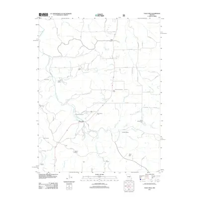
2011 Map of Yancy Mills
USGS Topo · Published 2011About this map
Yancy Mills serves as a central point in this part of Phelps County, situated where the Little Piney Creek valley meets a network of springs and hollows. The presence of the Yancy Mills Post Office and the nearby Lane Spring Campground reflects a landscape historically shaped by both rural administration and the recreational appeal of the Ozark waterways. Further north, the settlement of Vida sits at the intersection of State Hwy W and Cardinal Rd, surrounded by family-named landmarks and several cemeteries that anchor the local genealogy of the area.
Find a feature on this map
66 named features on this map. Tap any name to fly to it.
Don’t see what you’re looking for? This feature index may not catch every label — zoom into the map to look around manually.
Map Details
Editions of this 2011 Yancy Mills Map
This is the sole edition of this map. No revisions or reprints were ever made.
Other maps of this area

1912 · Rolla
USGS Topo · 1:62,500

1928 · Meramec Spring
USGS Topo · 1:62,500

1937 · Edgar Springs
USGS Topo · 1:48,000

1941 · Salem
USGS Topo · 1:62,500

1945 · Salem
USGS Topo · 1:62,500

1945 · Edgar Springs
USGS Topo · 1:62,500

1949 · Rolla
USGS Topo · 1:250,000

1949 · Meramec Spring
USGS Topo · 1:62,500

1950 · Newburg
USGS Topo · 1:24,000
1950 · Kaintuck Hollow
USGS Topo · 1:24,000