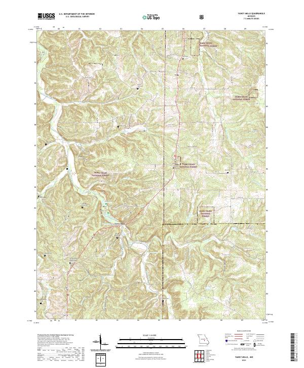
2021 Map of Yancy Mills
USGS Topo · Published 2021About this map
Yancy Mills and the small settlement of Vida serve as the primary points of human congregation in this portion of the Mark Twain National Forest. The landscape is defined by the winding course of Little Piney Creek and its many tributaries, including Corn Creek and Beaver Creek. For local historians and genealogists, the survey identifies several significant burial sites, most notably the Wright Slave Cem, reflecting the early social history of the region. The map also documents a number of family-named cemeteries such as George Lane Cem, Allen Cem, and Peck Cem, alongside the Old Philadelphia Baptist Church. This detailed record shows the persistence of small family plots and rural congregations throughout Phelps County and into Dent County. The presence of the Lane Springs Rec Area highlights the intersection of the river system with the managed forest lands of the Missouri Ozarks.
Find a feature on this map
66 named features on this map. Tap any name to fly to it.
Don’t see what you’re looking for? This feature index may not catch every label — zoom into the map to look around manually.
Map Details
Editions of this 2021 Yancy Mills Map
This is the sole edition of this map. No revisions or reprints were ever made.
Other maps of this area

1912 · Rolla
USGS Topo · 1:62,500

1928 · Meramec Spring
USGS Topo · 1:62,500

1937 · Edgar Springs
USGS Topo · 1:48,000

1941 · Salem
USGS Topo · 1:62,500

1945 · Salem
USGS Topo · 1:62,500

1945 · Edgar Springs
USGS Topo · 1:62,500

1949 · Rolla
USGS Topo · 1:250,000

1949 · Meramec Spring
USGS Topo · 1:62,500

1950 · Newburg
USGS Topo · 1:24,000
1950 · Kaintuck Hollow
USGS Topo · 1:24,000