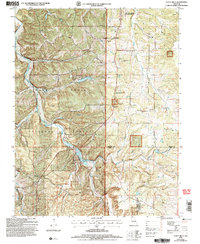
2004 Map of Yancy Mills
USGS Topo · Published 2006About this map
Yancy Mills P O sits at the heart of this Ozark landscape, where the confluence of Little Piney Creek and Gourd Creek shaped the early development of Phelps County. The terrain is defined by its extensive hollows and ridges, managed largely within the Mark Twain National Forest. Local history is preserved in a network of rural institutions, from the Ben Fore Sch in the northwest to the Rhea Ch and Rhea Cem in the east.
Find a feature on this map
47 named features on this map. Tap any name to fly to it.
Don’t see what you’re looking for? This feature index may not catch every label — zoom into the map to look around manually.
Map Details
Editions of this 2004 Yancy Mills Map
This is the sole edition of this map. No revisions or reprints were ever made.
Other maps of this area

1912 · Rolla
USGS Topo · 1:62,500

1928 · Meramec Spring
USGS Topo · 1:62,500

1937 · Edgar Springs
USGS Topo · 1:48,000

1941 · Salem
USGS Topo · 1:62,500

1945 · Salem
USGS Topo · 1:62,500

1945 · Edgar Springs
USGS Topo · 1:62,500

1949 · Rolla
USGS Topo · 1:250,000

1949 · Meramec Spring
USGS Topo · 1:62,500

1950 · Newburg
USGS Topo · 1:24,000
1950 · Kaintuck Hollow
USGS Topo · 1:24,000