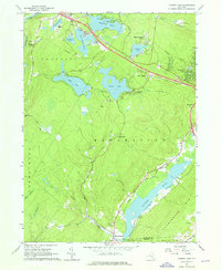
1966 Map of Yankee Lake
USGS Topo · Published 1968About this map
The Shawangunk Mts dominate the southeastern landscape of this mid-1960s survey, overlooking the prominent corridor of the Basher Kill. Tracing the valley floor reveals the clear path of the Delaware and Hudson Canal (Abandoned), which once served as a vital coal transportation route before the arrival of modern highways. This waterway's legacy is visible alongside settlements like Westbrookville and Haven, marking the intersection of 19th-century industrial transit and mid-century rural development.
Find a feature on this map
51 named features on this map. Tap any name to fly to it.
Don’t see what you’re looking for? This feature index may not catch every label — zoom into the map to look around manually.
Map Details
Editions of this 1966 Yankee Lake Map
3 editions found
Other maps of this area

1904 · Ellenville
USGS Topo · 1:62,500

1906 · Ellenville
USGS Topo · 1:62,500

1906 · Port Jervis
USGS Topo · 1:62,500

1906 · Goshen
USGS Topo · 1:62,500

1908 · Goshen
USGS Topo · 1:62,500

1908 · Port Jervis
USGS Topo · 1:62,500

1909 · Monticello
USGS Topo · 1:62,500

1911 · Monticello
USGS Topo · 1:62,500

1938 · Goshen
USGS Topo · 1:62,500

1942 · Port Jervis North
USGS Topo · 1:24,000