
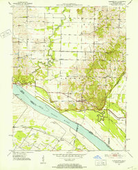
1951 Map of Yankeetown
USGS Topo · Published 1952About this map
The Ohio River dominates this mid-century survey, defining the border between Indiana and Kentucky and shaping the agricultural character of the bottomlands. Scattered settlements like Scuffletown and Carlinburg sit near the river's edge, while the northern uplands are marked by small rural communities such as Dayville and Pelzer. The drainage patterns are intricate, with Cypress Creek and Little Pigeon Creek winding through the terrain toward the main river channel, alongside man-made improvements like the George Bdy Horsman Ditch. Local life is anchored by a network of country churches, including Union Ch, Friendship Ch, and Sharon Ch. Evidence of early resource extraction appears via scattered Oil Wells, particularly in the northeastern corner near Bethany Ch. Genealogists may find value in the specific locations of rural burials at Vanada Cem and other family or church-affiliated sites near Bates Hill.
Find a feature on this map
31 named features on this map. Tap any name to fly to it.
Don’t see what you’re looking for? This feature index may not catch every label — zoom into the map to look around manually.
Map Details
Editions of this 1951 Yankeetown Map
2 editions found
Other maps of this area

1900 · De Gonia Springs
USGS Topo · 1:62,500

1901 · Owensboro
USGS Topo · 1:62,500

1902 · Ditney
USGS Topo · 1:125,000

1902 · Degonia Springs
USGS Topo · 1:62,500

1902 · Boonville
USGS Topo · 1:62,500

1905 · Newburg
USGS Topo · 1:62,500

1951 · Spottsville
USGS Topo · 1:24,000

1952 · Owensboro West
USGS Topo · 1:24,000

1952 · Newburgh
USGS Topo · 1:24,000

1952 · Reed
USGS Topo · 1:24,000