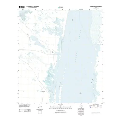
2010 Map of Yarborough Pass
USGS Topo · Published 2010About this map
Laguna Madre dominates this coastal landscape, serving as the wide aquatic corridor between the mainland and the slender reach of Padre Island. The map documents the intricate transition from the shallow waters of Baffin Bay to the marshy lowlands of Penascal Rincon. Inland, the sparse development is defined by scattered outposts like Carnestolendas Ranch, and small clusters at Los Corrales and Mota Negra. The presence of the Intracoastal Waterway cutting through the bay illustrates the vital navigation routes maintained along this stretch of the Texas coast. Notable landforms such as Potrero de los Caballos and the submerged sandbanks of Middle Ground provide critical detail for understanding the shifting hydrology of this barrier island ecosystem.
Find a feature on this map
11 named features on this map. Tap any name to fly to it.
Don’t see what you’re looking for? This feature index may not catch every label — zoom into the map to look around manually.
Map Details
Editions of this 2010 Yarborough Pass Map
This is the sole edition of this map. No revisions or reprints were ever made.
Other maps of this area

1928 · Sarita
USGS Topo · 1:125,000

1950 · Corpus Christi
USGS Topo · 1:250,000

1951 · South Bird Island SE
USGS Topo · 1:24,000

1951 · Point Of Rocks
USGS Topo · 1:24,000

1951 · Kleberg Point
USGS Topo · 1:24,000

1951 · Sarita 4 NE
USGS Topo · 1:24,000

1951 · South Bird Island
USGS Topo · 1:62,500

1952 · Potrero Cortado
USGS Topo · 1:24,000

1952 · Yarborough Pass
USGS Topo · 1:24,000

1952 · Sarita 4 SE
USGS Topo · 1:24,000