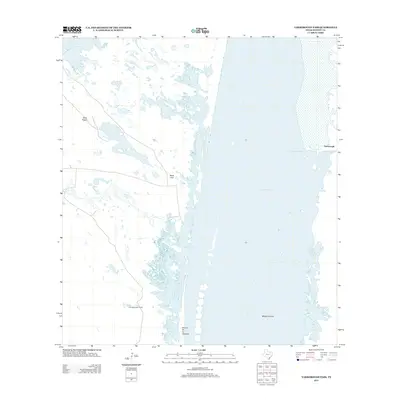
2013 Map of Yarborough Pass
USGS Topo · Published 2013About this map
Laguna Madre dominates this coastal landscape, where the shallow hypersaline lagoon meets the expansive mudflats and low-lying brush of Kenedy County. The map details the delicate transition from the mainland to the coastal waters, marked by features such as Rocky Slough and the central sandbars of the Middle Ground. Land use in this corner of South Texas is characterized by large historical landholdings and isolated outposts. Key locations such as the Carnestolendas Ranch and Potrero de los Caballos reflect the enduring ranching tradition of the Wild Horse Desert. At the northern edge, the waters of Baffin Bay enter the frame, while the crossing at Yarborough Pass provides a focal point for the narrow barrier island terrain of Yarborough, highlighting the seasonal and geographic shifts in this tide-influenced environment.
Find a feature on this map
10 named features on this map. Tap any name to fly to it.
Don’t see what you’re looking for? This feature index may not catch every label — zoom into the map to look around manually.
Map Details
Editions of this 2013 Yarborough Pass Map
This is the sole edition of this map. No revisions or reprints were ever made.
Other maps of this area

1928 · Sarita
USGS Topo · 1:125,000

1950 · Corpus Christi
USGS Topo · 1:250,000

1951 · South Bird Island SE
USGS Topo · 1:24,000

1951 · Point Of Rocks
USGS Topo · 1:24,000

1951 · Kleberg Point
USGS Topo · 1:24,000

1951 · Sarita 4 NE
USGS Topo · 1:24,000

1951 · South Bird Island
USGS Topo · 1:62,500

1952 · Potrero Cortado
USGS Topo · 1:24,000

1952 · Yarborough Pass
USGS Topo · 1:24,000

1952 · Sarita 4 SE
USGS Topo · 1:24,000