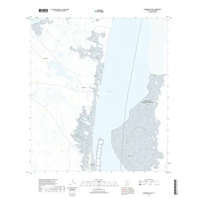
2019 Map of Yarborough Pass
USGS Topo · Published 2019About this map
Laguna Madre serves as the central focal point of this coastal survey, separating the mainland of Kenedy County from the protected lands of Padre Island National Seashore. The waterway is bisected by the Intracoastal Waterway, a critical navigation channel that runs north toward Baffin Bay. Along the western shoreline, the landscape is defined by isolated settlements and landforms like Mota Negra, Mota Casa, and Penascal Rincon, reflecting the sparse habitation and ranching heritage of this portion of the Texas coast. Significant shallow-water features and wetlands, such as Middle Ground and the Potrero de los Caballos peninsula, illustrate the complex maritime geography of the hypersaline lagoon system. This map captures the intersection of federal conservation efforts and essential maritime infrastructure in a relatively undeveloped coastal environment.
Find a feature on this map
9 named features on this map. Tap any name to fly to it.
Don’t see what you’re looking for? This feature index may not catch every label — zoom into the map to look around manually.
Map Details
Editions of this 2019 Yarborough Pass Map
This is the sole edition of this map. No revisions or reprints were ever made.
Other maps of this area

1928 · Sarita
USGS Topo · 1:125,000

1950 · Corpus Christi
USGS Topo · 1:250,000

1951 · South Bird Island SE
USGS Topo · 1:24,000

1951 · Point Of Rocks
USGS Topo · 1:24,000

1951 · Kleberg Point
USGS Topo · 1:24,000

1951 · Sarita 4 NE
USGS Topo · 1:24,000

1951 · South Bird Island
USGS Topo · 1:62,500

1952 · Potrero Cortado
USGS Topo · 1:24,000

1952 · Yarborough Pass
USGS Topo · 1:24,000

1952 · Sarita 4 SE
USGS Topo · 1:24,000