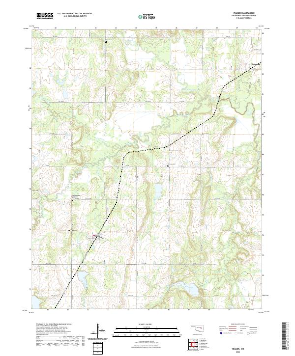
2022 Map of Yeager
USGS Topo · Published 2022About this map
The settlement of Yeager sits at the heart of this Hughes County landscape, where the local road network of Lafayette Ave and section lines like N S 375 Rd connect scattered homesteads and community sites. This area is deeply defined by its spiritual and ancestral landmarks, notably the Wewoka Indian Methodist Church-Cem and several family or community burial grounds including Yeager Cem, Fairview Cem, and Wisner Cem.
Find a feature on this map
46 named features on this map. Tap any name to fly to it.
Don’t see what you’re looking for? This feature index may not catch every label — zoom into the map to look around manually.
Map Details
Editions of this 2022 Yeager Map
This is the sole edition of this map. No revisions or reprints were ever made.
Other maps of this area

1900 · Wewoka
USGS Topo · 1:125,000

1954 · Oklahoma City
USGS Topo · 1:250,000

1957 · Oklahoma City
USGS Topo · 1:250,000

1963 · Oklahoma City
USGS Topo · 1:250,000

1967 · Cromwell
USGS Topo · 1:24,000

1967 · Okemah SE
USGS Topo · 1:24,000

1967 · Weleetka
USGS Topo · 1:24,000
1970 · Lamar
USGS Topo · 1:24,000
1971 · Wetumka
USGS Topo · 1:24,000
1972 · Wewoka East
USGS Topo · 1:24,000