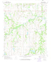
1972 Map of Yeager
USGS Topo · Published 1974About this map
The small rural community of Yeager and the surrounding Hughes County landscape are defined by the winding course of Wewoka Creek and a dense network of energy infrastructure. Surveyed in the early 1970s, the area shows an economy rooted in oil and gas extraction, with numerous Oil Wells and a Pumping Station scattered across the countryside. The St Louis-San Francisco railroad cuts diagonally through the terrain, serving as a primary transportation artery for the region's resources.
Find a feature on this map
21 named features on this map. Tap any name to fly to it.
Don’t see what you’re looking for? This feature index may not catch every label — zoom into the map to look around manually.
Map Details
Editions of this 1972 Yeager Map
This is the sole edition of this map. No revisions or reprints were ever made.
Other maps of this area

1900 · Wewoka
USGS Topo · 1:125,000

1954 · Oklahoma City
USGS Topo · 1:250,000

1957 · Oklahoma City
USGS Topo · 1:250,000

1963 · Oklahoma City
USGS Topo · 1:250,000

1967 · Cromwell
USGS Topo · 1:24,000

1967 · Okemah SE
USGS Topo · 1:24,000

1967 · Weleetka
USGS Topo · 1:24,000
1970 · Lamar
USGS Topo · 1:24,000
1971 · Wetumka
USGS Topo · 1:24,000
1972 · Wewoka East
USGS Topo · 1:24,000