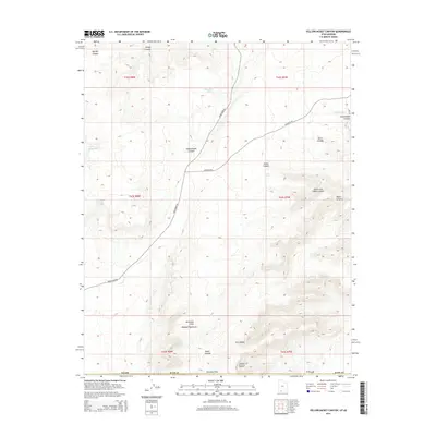
2014 Map of Yellowjacket Canyon
USGS Topo · Published 2014About this map
Vermilion Cliffs and the Moquith Mountains define the high-desert topography of this Kane County region along the Utah border. This landscape is characterized by a complex network of drainage systems including Yellowjacket Canyon, Cottonwood Canyon, and Indian Canyon. The availability of water in this arid environment is recorded through numerous named sources such as Yellowjacket Spring, Harris Springs, and Willow Spring, which likely served as vital landmarks for early travelers and cattlemen. Significant relief is found at Ed Lamb Point and within the deep cuts of Art Canyon and Cougar Canyon. Human transit through this section of the Kaibab plateau is largely restricted to established tracks like Sand Dunes Rd and Hancock Rd, reflecting the remote and challenging nature of the terrain in the early 21st century.
Find a feature on this map
28 named features on this map. Tap any name to fly to it.
Don’t see what you’re looking for? This feature index may not catch every label — zoom into the map to look around manually.
Map Details
Editions of this 2014 Yellowjacket Canyon Map
This is the sole edition of this map. No revisions or reprints were ever made.
Other maps of this area

1886 · Kanab
USGS Topo · 1:250,000

1886 · Kaibab
USGS Topo · 1:250,000

1953 · Cedar City
USGS Topo · 1:250,000

1953 · Grand Canyon
USGS Topo · 1:250,000

1954 · Kanab SW
USGS Topo · 1:24,000

1954 · Fredonia NW
USGS Topo · 1:24,000

1954 · Kanab SE
USGS Topo · 1:24,000

1954 · Fredonia NE
USGS Topo · 1:24,000

1954 · Fredonia
USGS Topo · 1:62,500

1954 · Short Creek
USGS Topo · 1:62,500