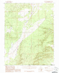
1985 Map of Yellowjacket Canyon
USGS Topo · Published 1985About this map
The Coral Pink Sand Dunes State Reserve dominates this high-desert landscape, where shifting sands meet the structural boundaries of the Moquith Mountains and the Vermilion Cliffs. In this 1985 survey, the intersection of the Utah-Arizona border and the Kane-Mohave county line highlights the geography of the Kaibab Indian Reservation at the southern edge of the sheet.
Find a feature on this map
31 named features on this map. Tap any name to fly to it.
Don’t see what you’re looking for? This feature index may not catch every label — zoom into the map to look around manually.
Map Details
Editions of this 1985 Yellowjacket Canyon Map
This is the sole edition of this map. No revisions or reprints were ever made.
Other maps of this area

1886 · Kanab
USGS Topo · 1:250,000

1886 · Kaibab
USGS Topo · 1:250,000

1953 · Cedar City
USGS Topo · 1:250,000

1953 · Grand Canyon
USGS Topo · 1:250,000

1954 · Kanab SW
USGS Topo · 1:24,000

1954 · Fredonia NW
USGS Topo · 1:24,000

1954 · Kanab SE
USGS Topo · 1:24,000

1954 · Fredonia NE
USGS Topo · 1:24,000

1954 · Fredonia
USGS Topo · 1:62,500

1954 · Short Creek
USGS Topo · 1:62,500