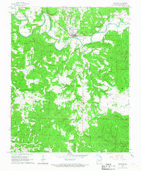
1966 Map of Yellville
USGS Topo · Published 1967About this map
Crooked Creek meanders sharply through the north-central portion of this mid-1960s Ozark landscape, defining the layout of Yellville and the nearby town of Summit. The area's topography is marked by significant natural landmarks such as Natural Bridge and the Shawnee Cave to the south, while the ridge lines are punctuated by summits like Bald Jesse and Hall Mountain. Human activity is centered around the intersection of Highway 62 and Highway 14, where the Yellville-Summit Sch serves the local community.
Find a feature on this map
56 named features on this map. Tap any name to fly to it.
Don’t see what you’re looking for? This feature index may not catch every label — zoom into the map to look around manually.
Map Details
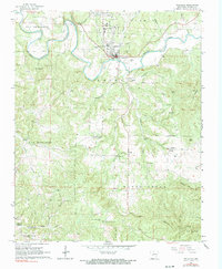
Editions of this 1966 Yellville Map
2 editions found
Other maps of this area

1893 · Yellville
USGS Topo · 1:125,000

1903 · Yellville
USGS Topo · 1:125,000

1905 · Yellville
USGS Topo · 1:125,000

1929 · Yellville
USGS Topo · 1:125,000

1945 · Harrison
USGS Topo · 1:250,000

1949 · Harrison
USGS Topo · 1:250,000

1954 · Harrison
USGS Topo · 1:250,000

1958 · Harrison
USGS Topo · 1:250,000

1964 · Harrison
USGS Topo · 1:250,000
1966 · Cozahome
USGS Topo · 1:24,000