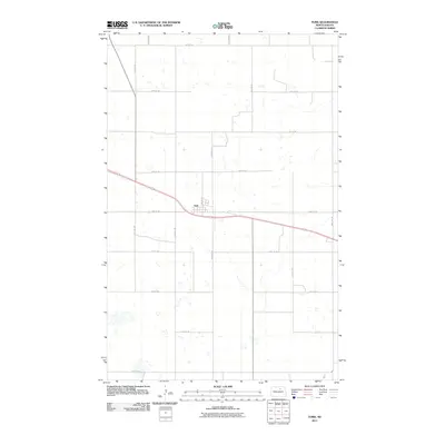
2011 Map of York
USGS Topo · Published 2011About this map
The settlement of York sits as the central landmark in this Benson County landscape, defined by its traditional grid centered on Main Ave. Positioned along a major transportation corridor, the town is the hub for a strictly organized section-line road network that serves the surrounding agricultural prairie. These routes, including 66th St Ne and 60th St Ne, form a precise geometric lattice typical of the Great Plains' rural infrastructure. The terrain is marked by numerous small, scattered wetlands and depressions that interrupt the cultivated fields, illustrating the characteristic prairie pothole geography of the region. This 2011 survey captures the area's enduring reliance on its original surveying framework, with a landscape largely unchanged in its fundamental layout since the early days of homesteading.
Find a feature on this map
17 named features on this map. Tap any name to fly to it.
Don’t see what you’re looking for? This feature index may not catch every label — zoom into the map to look around manually.
Map Details
Editions of this 2011 York Map
This is the sole edition of this map. No revisions or reprints were ever made.
Other maps of this area

1953 · Devils Lake
USGS Topo · 1:250,000

1956 · Devils Lake
USGS Topo · 1:250,000

1957 · Comstock
USGS Topo · 1:24,000

1958 · Baker
USGS Topo · 1:24,000

1958 · Harlow
USGS Topo · 1:24,000

1971 · Wolford
USGS Topo · 1:24,000

1971 · Knox
USGS Topo · 1:24,000

1971 · Hurricane Lake West
USGS Topo · 1:24,000

1971 · York
USGS Topo · 1:24,000

1971 · Leeds
USGS Topo · 1:24,000