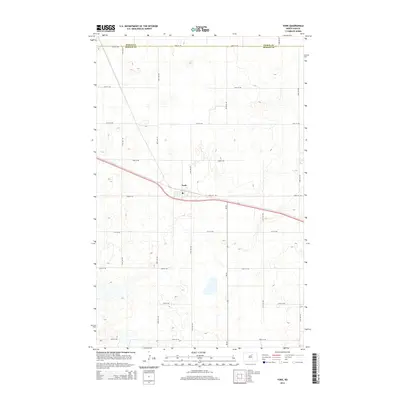
2014 Map of York
USGS Topo · Published 2014About this map
York serves as the central hub of this northern prairie landscape, situated where the east-west corridor of Us-2 meets the northern terminus of Nd-30. The settlement is defined by its small-town infrastructure, including the local Po and a grid of streets that transition quickly into a vast section-line road network. The map reveals the precise intersection of Pierce Co and Benson Co along its northern edge, a boundary that follows 66th St NE.
Find a feature on this map
21 named features on this map. Tap any name to fly to it.
Don’t see what you’re looking for? This feature index may not catch every label — zoom into the map to look around manually.
Map Details
Editions of this 2014 York Map
This is the sole edition of this map. No revisions or reprints were ever made.
Other maps of this area

1953 · Devils Lake
USGS Topo · 1:250,000

1956 · Devils Lake
USGS Topo · 1:250,000

1957 · Comstock
USGS Topo · 1:24,000

1958 · Baker
USGS Topo · 1:24,000

1958 · Harlow
USGS Topo · 1:24,000

1971 · Wolford
USGS Topo · 1:24,000

1971 · Knox
USGS Topo · 1:24,000

1971 · Hurricane Lake West
USGS Topo · 1:24,000

1971 · York
USGS Topo · 1:24,000

1971 · Leeds
USGS Topo · 1:24,000