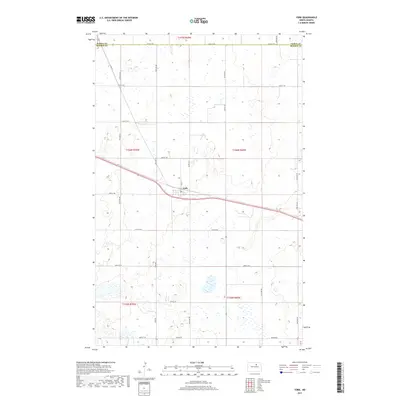
2017 Map of York
USGS Topo · Published 2017About this map
The settlement of York sits at a geographic crossroads in North Dakota, where the boundary between Pierce Co and Benson Co runs along the northern edge of this map. This 2017 survey reveals the distinct section-line grid of the Great Plains, where roads like York Rd and 60th St NE organize the landscape into precise agricultural squares. At the heart of the community, the Po and Main St represent the civic core, while the surrounding terrain is defined by a dense network of wetlands and small water bodies that punctuate the prairie.
Find a feature on this map
29 named features on this map. Tap any name to fly to it.
Don’t see what you’re looking for? This feature index may not catch every label — zoom into the map to look around manually.
Map Details
Editions of this 2017 York Map
This is the sole edition of this map. No revisions or reprints were ever made.
Other maps of this area

1953 · Devils Lake
USGS Topo · 1:250,000

1956 · Devils Lake
USGS Topo · 1:250,000

1957 · Comstock
USGS Topo · 1:24,000

1958 · Baker
USGS Topo · 1:24,000

1958 · Harlow
USGS Topo · 1:24,000

1971 · Wolford
USGS Topo · 1:24,000

1971 · Knox
USGS Topo · 1:24,000

1971 · Hurricane Lake West
USGS Topo · 1:24,000

1971 · York
USGS Topo · 1:24,000

1971 · Leeds
USGS Topo · 1:24,000