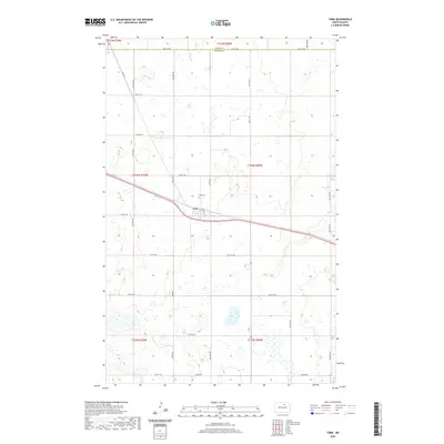
2020 Map of York
USGS Topo · Published 2020About this map
York serves as the central hub of this prairie landscape, situated near the intersection of Main St and York Rd. Located on the boundary where Pierce Co meets Benson Co, the settlement is defined by its grid-iron street pattern and proximity to the regional transport corridor. The surrounding countryside is a mosaic of glacial depressions and wetlands, characteristic of the North Dakota pothole region, with scattered water bodies interspersed among agricultural sections. To the north of the village, York Cem sits as a quiet landmark for local genealogists. The road network, including Beaver Rd and numerous numbered section-line avenues like 53rd Ave NE, illustrates the orderly township and range system that organized the Great Plains for settlement and farming.
Find a feature on this map
30 named features on this map. Tap any name to fly to it.
Don’t see what you’re looking for? This feature index may not catch every label — zoom into the map to look around manually.
Map Details
Editions of this 2020 York Map
This is the sole edition of this map. No revisions or reprints were ever made.
Other maps of this area

1953 · Devils Lake
USGS Topo · 1:250,000

1956 · Devils Lake
USGS Topo · 1:250,000

1957 · Comstock
USGS Topo · 1:24,000

1958 · Baker
USGS Topo · 1:24,000

1958 · Harlow
USGS Topo · 1:24,000

1971 · Wolford
USGS Topo · 1:24,000

1971 · Knox
USGS Topo · 1:24,000

1971 · Hurricane Lake West
USGS Topo · 1:24,000

1971 · York
USGS Topo · 1:24,000

1971 · Leeds
USGS Topo · 1:24,000